
Website matulji.hr Population 11,246 (2011) Area code 051 | Time zone CET (UTC+1) Area 13 km² Local time Wednesday 2:16 PM | |
 | ||
Weather 17°C, Wind SW at 6 km/h, 35% Humidity | ||
Matulji (Italian: Mattuglie) is a town and a municipality in Primorje-Gorski Kotar County, Croatia. It is located 10 kilometers (6 mi) west of the Croatian town Rijeka, north of the town of Opatija, and it borders Slovenia.
Contents
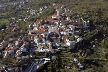
Map of Matulji, Croatia
The municipality
There are a total of 11,246 inhabitants in the municipality, in the following settlements:
In the 2011 census, 90.87% were Croats.
Communications
The municipality is of great transportation importance because of the major railway and highway networks connecting Rijeka with Ljubljana and Trieste to the west, Zagreb and Split to the east and Pula to the south through the Učka tunnel. Sixty five percent of the annual Croatian border traffic takes place through four international border crossings - Pasjak (with Starod in Ilirska Bistrica municipality on the Slovenian side), Rupa (with Jelšane), Mune (with Starod), and Lipa (with Novokračine) - within the Matulji municipality. Šapjane, a main railway crossing into Slovenia with Ilirska Bistrica) on the Slovenian side, is also in the municipality.
A post office opened on 21 October 1891, with the bilingual name MATTUGLIE-ABBAZIA BAHNHOF / MATULJE-OPATIJA KOLODVOR.
Matulji also houses the A7 highway and A8 motorway and six of their interchanges.
Folklore
The region is well known locally for its Istro-Romanian folklore, namely Zvončari during the carnival festivities.