
Population 570 (2011) Country Wales Postcode district SA67 8 Local time Tuesday 1:02 AM | OS grid reference SN034106 Sovereign state United Kingdom Police Dyfed-Powys | |
 | ||
Weather 9°C, Wind W at 11 km/h, 97% Humidity Points of interest Oakwood Theme Park, Blue Lagoon Water Park, Bluestone Adventure Centre, National Trust ‑ Cleddau | ||
Martletwy is a village, parish and community in the county of Pembrokeshire, Wales.
Contents
- Map of Martletwy UK
- Description
- History
- Martletwy parish
- Martletwy Community
- Governance
- Notable places
- References
Map of Martletwy, UK
Description
Martletwy lies in south of the county, the nearest town is Narberth some 7 miles distant to its north and east. It lies mainly to the west of the A4075 road, which links Carew in the south with the Canaston Bridge junction at the A40 road, although part of the Cross Hands area bridges the main road. To the west and south, the area's boundary is the Eastern Cleddau, to the southeast the River Cresswell forms its boundary.
History
According to Lewis, the population of the parish in 1833 was 725. He described the area as good arable and pasture land, which was enclosed, and considerable supplies of coal and culm on the estate of Sir John Owen, which was shipped from a specially-constructed quay at Landshipping on the Eastern Cleddau.
Martletwy parish
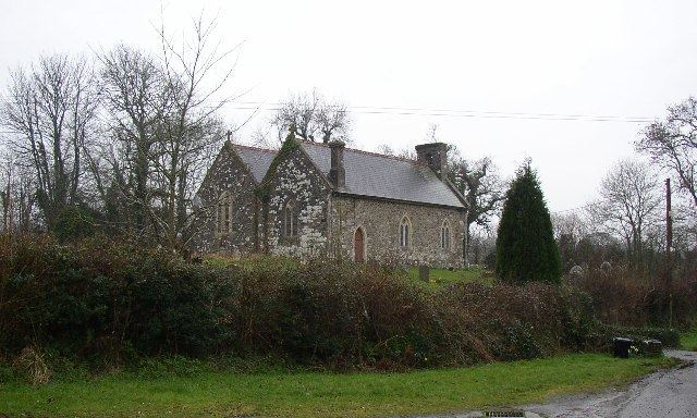
The parish church is dedicated to St Marcellus and is in the diocese of St David's. There are Baptist, Methodist and Independent chapels.
Martletwy Community
Martletwy consists of the following parishes: Martletwy, Coedcanlas, Minwear, Newton North and Lawrenny.
Governance
An electoral ward in the same name exists. This ward stretches beyond the confines of Martletwy community and had a total population at the 2011 Census of 1,970.
Notable places
The village is best known for being home to the Oakwood theme park.