
Population 3,531 (2011) Civil parish Marham Area 14.85 km² | OS grid reference TF 709 100 Sovereign state United Kingdom Local time Tuesday 9:50 AM Number of airports 1 | |
 | ||
Weather 7°C, Wind W at 35 km/h, 69% Humidity District King's Lynn and West Norfolk | ||
Marham is a village and civil parish in the English county of Norfolk, approximate 12 miles (19 km) away from King's Lynn. An RAF station, RAF Marham, is situated nearby at Upper Marham. The village covers an area of 1,485 ha (3,670 acres) and had a population of 2,951 in 788 households as of the 2001 census, increasing to 3,531 at the 2011 Census.
Contents
Map of Marham, UK
Governance
Marham is a parish of the Kings Lynn and West Norfolk district council, which is responsible for the most local services. Norfolk County Council is in charge of roads, some schools, and social services, and the county councillor is Richard Toby Coke (UKIP). For Westminster elections Marham forms part of the South West Norfolk constituency, represented by Elizabeth Truss (Conservative).
Religion
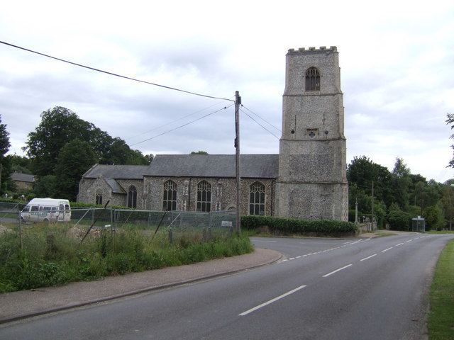
Holy Trinity Anglican church dates from Norman times and has a Norman doorway. Since its original design, each part of the building has been reconstructed. The doorway has a single-scallop shaft on each side. The semi-circular arch is high enough to allow the tympanum within to be filled with a checkered "lozenge" pattern.
Marham Methodist church joins with the Anglicans for some of its services.