
Country Canada Census division 17 Area code(s) -1+780 Population 1,183 (2016) | Time zone MST (UTC-7) Elevation 472 m Local time Monday 2:36 AM | |
 | ||
Weather -17°C, Wind W at 11 km/h, 70% Humidity | ||
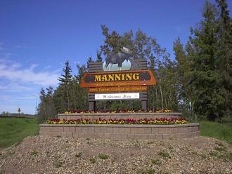
Canada day in manning alberta
Manning is a town in northern Alberta, Canada. It is known as the "Land of the Mighty Moose". It is located on Highway 35 on the Notikewin River, approximately 73 km (45 mi) north of Peace River.
Contents
- Canada day in manning alberta
- Map of Manning AB Canada
- Manning alberta changes come to the north
- History
- Climate
- Demographics
- Attractions
- Infrastructure
- Government
- Education
- Media
- References
Map of Manning, AB, Canada
Manning is a service centre for the local agriculture, forestry and gas industries. It also serves the nearby rural area within the County of Northern Lights including Deadwood, Hotchkiss, North Star and Notikewin.
Manning alberta changes come to the north
History
The original name "Aurora", was rejected by the postal authorities because of possibility of confusion with Aurora, Ontario. At a public meeting in 1947, the community was renamed in honour of Ernest Manning who was the premier of Alberta from 1943 to 1968.
Climate
Manning has a borderline subarctic climate, very close to being a humid continental climate, with both May and September averaging only fractionally under 10 °C (50 °F). There are vast differences between the warm summers and very cold winters, although areas much further south more eastward in Canada have equally cold winters and cooler summers. The climate data is from minor settlement Notikewin very close to the town.
Demographics
In the 2016 Census of Population conducted by Statistics Canada, the Town of Manning recorded a population of 1,183 living in 484 of its 544 total private dwellings, a 7000160000000000000♠1.6% change from its 2011 population of 1,164. With a land area of 4.05 km2 (1.56 sq mi), it had a population density of 292.1/km2 (756.5/sq mi) in 2016.
In the 2011 Census, the Town of Manning had a population of 1,164 living in 461 of its 501 total dwellings, a -22% change from its 2006 population of 1,493. With a land area of 3.42 km2 (1.32 sq mi), it had a population density of 340.4/km2 (881.5/sq mi) in 2011.
Attractions
The Battle River Pioneer Museum is home to many pieces of antique farming equipment, vehicles and other extraordinary items, like the albino moose and Cleave Whitaker's childhood crib.
The Manning Farmers’ Market has been a fixture in Manning for over 30 years.
Recreation venues include the Manning R.C.M.P. Centennial Pool, a paved walking trail, a curling rink, an skating/hockey arena, two outdoor ice rinks, a ski hill and the Condy Meadows Golf Course and Recreation Area.
Infrastructure
Manning has a hospital. It also has a newly constructed RCMP detachment, Fire Station and Skatepark. Along with an indoor/outdoor pool
Government
The mayor of the Town of Manning is Sunni-Jeanne Walker.
Education
Manning contains two public schools, Manning Elementary (K-6) and Paul Rowe High School (7-12); and one separate school, Rosary Separate School (K-9).
Media
Manning is served weekly by The Banner Post