
Postal Code 7440 Area 444.7 km² | Time zone BST (UTC+6) Website dcjessore.gov.bd | |
 | ||
Manirampur Upazila (Bengali: মণিরামপুর) is an upazila of Jessore District in the Division of Khulna, Bangladesh. It is bounded by Jessore Sadar Upazila on the north, Kalaroa and Jhikargachha upazilas on the west, Abhaynagar Upazila on the east, and Dumuria and Keshabpur upazilas on the south.
Contents
- Map of Manirampur Upazila Bangladesh
- Short History
- During 1971
- 1971 Liberation War
- Geography
- Demographics
- Economy
- Village Fairs
- Arts and culture
- Voluntary Organizations
- Points of interest
- Archaeological Sights
- Administration
- Political History
- Infrastructure
- Hospitals and clinics
- Education
- High Schools
- Colleges
- Madrasha
- University
- References
Map of Manirampur Upazila, Bangladesh
Short History
Manirampur upazila stands on the bank of Harihar river.
There is a hearsay that Manirampur was named after the name of Muniram Roy who was the lawyer of King Seetaram Roy. Certain woman from Chanchra basilica (King palace) dug a large pond here which still stands as the witness of time. It was dug on the first decade of nineteenth century. The kings constructed a road of nine kilometres from Manirampur to Rajgonj at the Trimohani connecting road. Manirampur is known from 1785. The first elected chairman of Manirampur was Md Lutfar Rahman and the first nirbahi officer (TNO/UNO) was Md S. M. Mizanur Rahman.
During 1971
Shaheed Asaduzzaman Asad, younger brother of Poet and Professor of Dhaka University Muhammad Moniruzzaman from Chinatola village was killed 23 October during the 1971. He was buried in Chinatola, near Chinatola bridge on the bank of Harihar river. Not only Asad,But also Sirajul Islam Shanti, Mashikur Rahman Tojo, Ahsan Uddin Khan Manik, Fazlur Rahman Fazlu were killed at the same time, same Place and they all are buried in a grave together.
They were bosom friend and leaders of political party. They were arrested together, killed together and buried together.
Shaheed Akram, Khanpur, Manirampur was killed at Juranpur, Manirampur.
1971 Liberation War
Manirampur thana was controlled by Sector 8 of the Bangladesh Armed Forces during the 1971 Bangladesh Liberation War. The sector's headquarters was at Benapole and it was commanded by Major Abu Osman Chowdhury (April 10 – July 17, 1971) and then Major MA Manzur (August 14, 1971 – February 14, 1972).
Memorials:
Geography
Manirampur is located at 23.0167°N 89.2333°E / 23.0167; 89.2333. Manirampur is the second largest upazila of Bangladesh with an area of 444.72 square kilometres (171.7 sq mi). Important low-lying areas include the Jhealdaha, Kedaria, Monaharpur and Moshihati beels. The main rivers in Manirampur are the Harihar and Vodra rivers. It is situated 12 miles (19 km) from the district town.
Demographics
As the census of 1991, the total population of Manirampur was 326,093. Males constitute 51% of the population and females 49%. The density of population was 733/km². The total people of eighteen years or older (18 or 18+) was 168,903 and the total number of households was 59,615. Manirampur had an average literacy rate of 29.1% (for people seven years or older), compared with the national average of 32.4%.
Only Town Population:
Only the Manirampur town had a population of 18874 as the census of 1991 where males are 52.36% and females are 47.64% of the town people. The density of town population was 1644/km² and the literacy rate of town people was 43.3%.
Economy
Main crops:
The main crops of Manirampur Upazila are Paddy, Wheat, Jute, Potato, Mustard etc. Extinct or nearly extinct crops Linseed, Indigo, Kaun, Arahar etc.
Main fruits:
Mango, Jackfruit, Papaya, Banana etc.
Main Exports:
Date molasses, Jute, Banana etc.
Manufactures:
Rice mill, Flour mill, Ice factory etc.
Cottage Industries:
Weaving,Goldsmith, Blacksmith, Potteries, Wood work, Tailoring and Welding.
Industries:
Manirampur is not an industrial area, but it has an industry also. It is: Uttara Food Industry (Producing Animal Food)
Village Fairs
Most famous Village Fairs of Manirampur Upazila are Mohonta Tala Mela Raghunarhpur (Balai Gushai Bari) near Garibpur Graveyard (Mahasmashan) and Khadapara Baidyanath Dham Mela held on the Month of ASHAR (June/July). It was more than Three Hundred Years old Mela.
Arts and culture
Manirampur Upazila's cultural organizations include:
Voluntary Organizations
Points of interest
The most notable place to see in Manirampur is Vabodah Sluis Gate and Jhapa (Rajgong) Baor. Rampur village is famous because it looks almost like an island. It is surrounded by Jhapa Baor and Khajura Baor. The famous Kapatakkha River also flows beside this area. Khedapara Baor, near the Khedapara bazar.
Archaeological Sights
A terracotta plaque bearing the image of Mallinath, a female tirthankar (saint) of the Jain religion, was found at the Mound of Dam Dam Peer in Manirampur Upazila.
It is believed to be the most ancient relic discovered from this part of the world. The Department at Khulna said that the plaque is at least 1800 years old. It is currently kept at the Khulna Museum.
Besides, "Neelkuthi" at village Joypur & "Kachari Ghar" are important Archaeological sites in Manirampur.
Administration
Manirampur thana was turned into an upazila in 1983. It consists of one municipality, 9 wards, 17 union parishads, 246 mouzas and 249 villages. The union parishads are:
Political History
The upazila's members of parliament (MP) were: Pijush Kanti Bhattacharya (AL), beginning in 1973 who is Current Presidium Member of Central AL; Afsar Siddiqui (BNP), beginning in 1979; Mufti Wakkas (JP), beginning in 1986; Tipu Sultan (AL), beginning in 1991, Tipu Sultan (AL), beginning in 1996; Mufti Wakkas (Jamat-e- Ulamai Islam), beginning in 2001; Tipu Sultan (AL), beginning in 2008 and Swapon Kumar Bhattyacharya (Ind) beginning in 2014.
The chairman of the upazila as of 2014 is Amzad Hossain Lavlu the first mayor of this municipality & the vice- chairmans are Mrs. Nazma khanom & Professor Fazlul Hauque.
The current mayor of Manirampur municipality is Principal Alhaz Kazi Mahmudul Hasan.
The upazila has produced one Minister, Sarat Chandra Mojumder (1955–58), and one State Minister of Religious Affairs, Mufti Wakkas, who held office under Hussain Muhammad Ershad.
Infrastructure
Roads:
Manirampur Upazila has 44 km pucca, 32 km semi pucca and 786 km mud road.
Traditional Transports:
PALANQUIN and Bullock cart.
Available Transports:
Bus, Mini-bus, Micro-bus, Car (rent),Easy-bike, Rickshaw- van, Motor-bike (rent), Minidoor, Tempoo, Tekar, Alam- sadhu, Nasiman, Kariman etc. The semeans of transport are either extinct or nearly extinct.
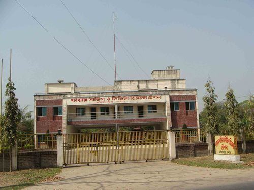
Hospitals and clinics
The upazila has one 100-bed upazila health complex and two union health centers, one at Nehalpur and the other at Rajgong and several community clinics. Government has also established 10 community health clinics (CHC) at the village level. One of them is situated in Parala village. There are several private small hospitals and clinics too.
Education
There are several educational institutions:
High Schools
According to Banglapedia, Rajganj Secondary School, founded in 1916, Kultia Girls High School (1924), Manirampur Government High School (1932), Dhakuria Protapkati Secondary School (1939), and Manirampur Government Girls' High School (1965) are notable secondary schools.
Moniampuur Technical Vocational School Manirampur Government Pilot High School Was Established in 1932. It's a boys' high school.
Manirampur Government Girls High School Was Established in 1965.
Somoskati Girls High School Was Established in 1994. There are many government and registered Primary School in Manirampur.
Dhakuria pratapkati M.L. High School was established in 1939. One of the oldest primary schools in this thana is situated in Parala.
Nagoreghope High school, established in 1970 is one of the most famous high school of the upazila.
Mashihati High School was established in 1918, started at the "Kachari Ghar" of "Mallick Bari" of village Kultia. Subsequently, Kultia Boys Primary School, Mashihati High School, Kultia Girls Primary/High School and Mashihati Degree College, Hostel, huge play grounds, large ponds, Post Office, Bank, Teacher's quarters, a small market place- all of them located within around 200–250 metres (660–820 ft) from each other, became an educational complex, known as the Oxford of 96 villages.
Shyamkur High School, established in 1968. There is an oldest primary school in this village, firstly Moinar bari primary school, then it is named shyamkur model primary school then shyamkur primary school. Nengurahat School and College, School established in 1968 & College established in 2015.
Colleges
Madrasha
There are some famous Madrashas in Manirampur upazila. Noted ones are: