
Name Manfred Buchroithner | ||
 | ||
Books Paradigms in Cartography: an Epistemological Review of the 20th and 21st Centuries | ||
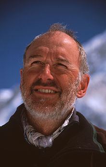
Manfred Ferdinand Buchroithner (born December 17, 1950 in Wels) is an Austrian cartographer, geologist, mountain researcher and mountaineer.
Contents
Biography
After finishing college (Realgymnasium) in Linz an der Donau, Austria, in 1969, he did his military service before studying geology and palaeontology as well as mineralogy and petrography at the University of Graz, Austria. In 1977 he became a certified UIAGM mountain guide. The same year he received his PhD in Graz and became research fellow there. In 1979 and 1980 he carried out postdoctoral studies in remote sensing and cartography at the International Institute for Aerospace Survey and Earth Sciences, (today the Faculty of Geo-Information Science and Earth Observation) of the University of Twente in Enschede, Netherlands. He took part in a lengthy scientific expedition to the Wakhan Corridor in Afghanistan in 1975.
In 1980 on he took a position at the Cartographic Institute of the Austrian Academy of Sciences in Vienna, Austria. In 1983 he went as a Fulbright-scholar for research stays to Fort Worth (Texas), Denver and Boulder (Colorado) as well as Stanford University (California). In 1984 he accomplished his habilitation in general geology and remote sensing at the University of Graz. 1984 to 1992 he was employee at, and as from 1985, head of the Institute of Digital Image Processing and Computer Graphics at Joanneum Research in Graz. In 1989 he taught as a visiting professor at the University of Munich. From 1992 on he was holding the position of Full Professor of Cartography at the Dresden University of Technology (Director of Institute for Cartography 1994-1997 and from 2003 until his retirement in 2016). In 2000 he was visiting professor at the University of Salzburg, Austria, in 2002 at the Center for Energy and Processes (CEP) of the École National Supérieur des Mines de Paris (ENSMP) in Sophia Antipolis, France, in 2015 at the Institute of Information Technology (IIT) of COMSATS in Islamabad, Pakistan, and at the University of Bergamo, Italy.
Mayor research fields of Buchroithner are true 3D visualization of geoinformation, high-mountain cartography (especially multitemporal 3D glacier mapping using spaceborne remote sensing and AI methods), and remote sensing cartography; furthermore dynamic cartography with remote sensing, geographic information systems, environmental monitoring, digital media and multimedia in cartography, as well as epistomology of cartography. Applications include the cartigraphic coverage of the Wadden Sea which defies exact ground born coverage, with data from space missions. He initiated and led several scientific expeditions to high-alpine areas all over the world. In 1997/98 Buchroithner produced the first holographic relief map worldwide (with motion-animated labeling) and displayed it at the 1999 International Cartographic Conference (ICC) in Ottawa. His developments in true-3D cartography by means of lenticular foil technology in the late 1990s led to two international patents.
Since 1992 Manfred Buchroithner has been scientific advisor of the Tibetan Mount Everest National Park Qomolangma National Nature Preserve (QNNP). From 1993 to 1997 he was Vice President of the European Association of Remote Sensing Laboratories (EARSeL), where he also chaired a SIG on landslides and mudflows, and from 1999 to 2001 of EURO-STRIM (Association for the Establishment of a European Master and Doctorate in Space Technologies for Risk Management). Since 2002 Buchroithner is Vice President of the German Cartographic Society (DGfK) International and since 2003 German National Delegate to the International Cartographic Association (ICA). In 2011, in his capacity as Chairman of the German Society for the Support of Geodesy and Geoinformation, Buchroithner initiated the Wissenschaftspreis der Deutschen Geodätischen Kommission (DGK-Preis, Science Award of the German Geodetic Commission) for postdoctoral researchers in these fields. Buchroithner was instrumental in founding three Commissions of the International Cartographic Association (ICA), the Commission on Mountain Cartography (1995), the Commission on Planetary Cartography (1995) and the Commission on Cartography in Early Warning and Crisis Management (2003).
Manfred Buchroithner is married and has a son and a daughter.
Achievements in mountaineering
Apart from initiating and leading numerous scientific high-mountain expeditions into the ranges of High Asia and the Andes, Buchroithner was also successful as a mountaineer. He made first ascents of Koh-e Asp-e Safed (6101 m, Afghan Pamir, 1975, solo) and Tenzin Gyatso Peak (5984 m, Tibetan Himalaya, south of Karo La, later in Chinese maps indicated as Jitan Zhoma, 6004m, 1992, together with Hans-Dieter Sauer and Bernhard Jüptner). Buchroithner took part at the second ascend of Koh-e Bardar (6078 m, Afghan Pamir, via the North Ridge, with Gernot Patzelt, Heinz Badura and Martin Posch) in 1975, three days after the first ascend by a Polish expedition. In 1978 he and Rudi Brandstetter opened a new direct route through the East Face of Nevado Rasac (6017 m, Cordillera Huayhuash, Peruvian Andes).
He climbed, most times solo, several 6000 m and numerous 5000 m peaks in the Andes and in the ranges of High Asia. As a rock climber opened several new routes in the climbing sites south west of Vienna and in the Grazer Bergland of the Austrian Alps. He also soloed numerous rock and mixed routes in the entire Alps, Scandinavia, the Rocky Mountains, the Andes, the HKH Ranges, on Borneo and in New Zealand.
Due to his expertise both in mountaineering and cartography Buchroithner contributed to a number of Alpine Club maps that are published jointly by the Austrian and the German Alpine Club. Examples include: