
Headquarters Mamit Area 3,025 km² | Website Official website | |
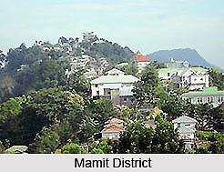 | ||
Mamit district is one of the eight districts of Mizoram state in India.
Contents
Map of Mamit, Mizoram
Geography
The district is bounded on the north by Hailakandi district of Assam state, on the west by North Tripura district of Tripura state and Bangladesh, on the south by Lunglei district and on the east by Kolasib and Aizawl districts. The district occupies an area of 3025.75 km². Mamit town is the administrative headquarters of the district.
Divisions
The district has 4 R.D. Blocks, Mamit, Reiek, West Phaileng and Zawlnuam. The district has 3 legislative assembly constituencies. These are Hachhek, Dampa and Mamit.
Demographics
According to the 2011 census Mamit district has a population of 85,757, roughly equal to the nation of Andorra. This gives it a ranking of 618th in India (out of a total of 640). The district has a population density of 29 inhabitants per square kilometre (75/sq mi) . Its population growth rate over the decade 2001-2011 was 37.56%. Mamit has a sex ratio of 927 females for every 1000 males, and a literacy rate of 84.93%.
Flora and fauna
In 1985 Mamit district became home to Dampa Tiger Reserve, which has an area of 500 km².