
Elevation 224 m Local time Sunday 2:16 PM | Time zone IST (UTC+5:30) Population 17,181 (2001) | |
 | ||
Weather 36°C, Wind SE at 5 km/h, 37% Humidity | ||
Mallasamudram is a Town Panchayat in Thiruchengode taluk, Namakkal district in the Indian state of Tamil Nadu. Mallasamudram is about 25 km from Salem on the Salem - Tiruchengode Road, via Attayampatti. It has an average elevation of 224 metres (734 feet).
Contents
Map of Mallasamudram, Tamil Nadu 637503
Demographics
As of 2001 India census, Mallasamudram had a population of 17,125. Males constitute 51% of the population and females 49%. Mallasamudram has an average literacy rate of 62%, higher than the national average of 59.5%: male literacy is 70%, and female literacy is 53%. In Mallasamudram, 10% of the population is under 6 years of age.
Economy
The major occupation of the people is textile weaving and agriculture. Gada, dhothis, towels, bedsheets are some of the town's textile products.
Temples
Solishwaran (Lord Siva) Temple, Mallai Periya Marriyaman Temple, Chinna Marriyamman Temple, Mallai Sri Angalamman Temple, Sellandiyamman Temple and Kalipatti Kandasamy temple are the major temples.
Health
Government primary health center is situated in Mallasamudram to Paruthipalli Main Road, Mallasamudram.
Education
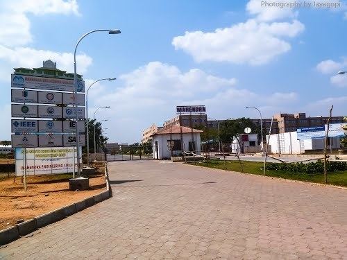
There are elementary, primary, secondary as well as higher secondary schools in Mallasamudram. Mallasamudram has three private engineering colleges and a polytechnic college.
Distances
Namakkal -42 km
Tiruchengode -18 km
Rasipuram - 24 km
Sankagiri - 21 km
Erode - 40.5 km
Salem - 25 km Namakkal 27