
Country Thailand Postal code 22150 Area 480.1 km² Province Chanthaburi Province | Time zone ICT (UTC+7) Geocode 2205 Population 29,479 (2005) | |
 | ||
Makham (Thai: มะขาม, [mā.kʰǎːm]) is a district (amphoe) in the center part of Chanthaburi Province, eastern Thailand.
Contents
Map of Makham District, Chanthaburi, Thailand
History
The district was established in 1899, then named Tha Luang district. It dates back to an ancient Khmer city, which was under Thai rule since the Ayutthaya era. In 1917, it was renamed Makham.
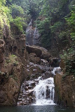
Geography
Neighboring districts are (from the southwest clockwise) Mueang Chanthaburi, Khao Khitchakut, Pong Nam Ron, and Khlung of Chanthaburi Province.
The important water resource is the Chanthaburi River.
Administration
The district is subdivided into 6 subdistricts (tambon), which are further subdivided into 59 villages (muban). Makham is a subdistrict municipality (thesaban tambon) which covers parts of tambon Makham. There are further 6 tambon administrative organizations (TAO).
Missing numbers are tambon which now form Khao Khitchakut district.