
Car plates WMA Population 46,474 (2006) | Area 1,065 km² | |
 | ||
Gminas Total 10 (incl. 1 urban)Maków MazowieckiGmina CzerwonkaGmina KarniewoGmina KrasnosielcGmina MłynarzeGmina Płoniawy-BramuraGmina RóżanGmina RzewnieGmina SypniewoGmina Szelków Website | ||
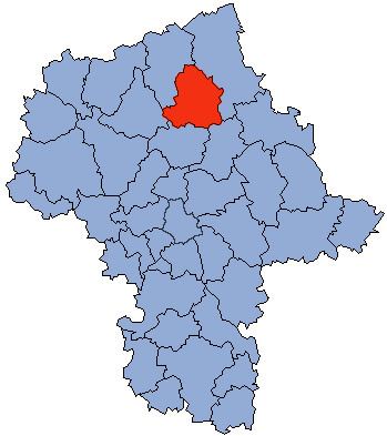
Maków County (Polish: powiat makowski) is a unit of territorial administration and local government (powiat) in Masovian Voivodeship, east-central Poland. It came into being on January 1, 1999, as a result of the Polish local government reforms passed in 1998. Its administrative seat and largest town is Maków Mazowiecki, which lies 73 kilometres (45 mi) north of Warsaw. The only other town in the county is Różan, lying 20 km (12 mi) east of Maków Mazowiecki.
Contents
Map of Mak%C3%B3w County, Poland
The county covers an area of 1,064.56 square kilometres (411.0 sq mi). As of 2006 its total population is 46,474, out of which the population of Maków Mazowiecki is 9,880, that of Różan is 2,661, and the rural population is 33,933.
Neighbouring counties
Maków County is bordered by Ostrołęka County to the north-east, Wyszków County to the south-east, Pułtusk County to the south, Ciechanów County to the west and Przasnysz County to the north-west.
Administrative division
The county is subdivided into 10 gminas (one urban, one urban-rural and eight rural). These are listed in the following table, in descending order of population.