 | ||
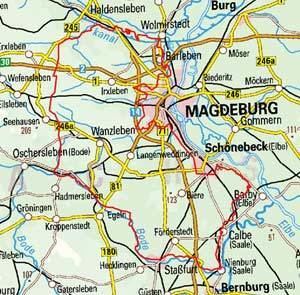
The Magdeburg Börde (German: Magdeburger Börde) is the central landscape unit of the state of Saxony-Anhalt and lies to the West and South of the eponymous state capital Magdeburg. It is noted for its very fertile soils.
Contents
Boundaries
The boundaries of the Magdeburg Börde are very ill-defined. Only to the west there is a clear boundary, with Lower Saxony, which separates it from the Hildesheim Börde. To the northwest it is bordered by the nature park of the Drömling near Oebisfelde. To the north the Börde merges into the Altmark, being also a part of Saxony-Anhalt. The boundary here is generally reckoned to be coincident with the river Ohre or the Colbitz-Letzlingen Heath. In any case, the Flechtingen Hills south of the Ohre only partly belong to the Magdeburg Börde. Its eastern boundary is mainly defined by the river Elbe, but several villages east of Magdeburg also consider themselves as part of the Börde. To the southeast the Börde passes into the Middle Elbe Biosphere Reserve. Its transition to Mansfeld Land to the southeast is also gradual. To the south lie the Harz Mountains, where an area of the adjacent Harz Foreland is also considered part of the Börde.
The Magdeburg Börde is crossed by the rivers Bode, Aller and Saale.
General
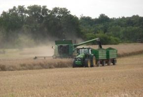
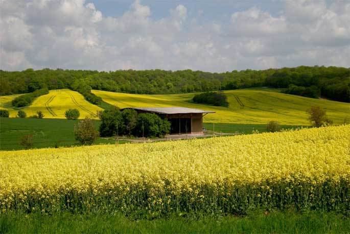
The landscape is gently undulating and largely treeless. The underlying terrain mainly comprises loose morainic material from the Saale glaciation period with individual outcrops of older rock. This older bedrock and loose morainic debris is mostly obscured by a covering of wind-blown loess. The area has very fertile soils (partly of black earth), on which sugar beet and wheat are the main crops. In 1934 the soil in the old municipality of Eickendorf (today Bördeland) was given a soil value of 100, which made it the richest soil in Germany, and it was used until the division of Germany in 1945 as a yardstick for the quality of German soils.
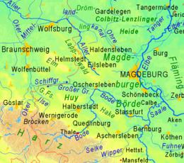
The Magdeburg Börde lies in the rain shadow of the Harz Mountains and is consequently one of the driest regions of Germany, albeit not the warmest or sunniest. The highest elevation on the Magdeburg Börde is the Großer Wartberg near Niederndodeleben with a height of 145.7 m.
In the Magdeburg Börde traditionally the Low German dialect Bördeplatt is spoken, though the number of speakers is declining.