
Country New Zealand Area 7,339 km² | Region Canterbury Website www.mackenzie.govt.nz | |
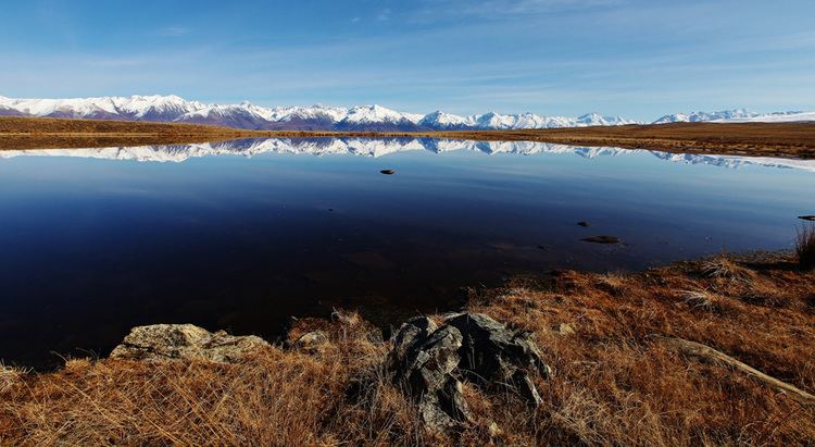 | ||
Destinations Points of interest Aoraki/Mount Cook National, Tasman Glacier, Roundhill Ski Area, Hooker Valley Track, Lake Tekapo | ||
Mackenzie District is a political district in New Zealand's South Island administered by the Mackenzie District Council. It is part of the larger Canterbury region.
Contents
- Map of Mackenzie District Canterbury New Zealand
- Principal settlements
- Geography
- Economy
- Climate
- History
- Mountains
- Lakes
- Glaciers
- Skifields
- National parks
- Mayor
- References
Map of Mackenzie District, Canterbury, New Zealand
Principal settlements
The Mackenzie District only has three towns with a permanent population over 300 at the 2013 census:
Other smaller settlements include:
Geography
Economy
A relatively weakly settled area, the district does have a wide number of farms. However, in the late 2000s, numerous proposals for new farming operations have locals fearing that the agriculture will be transformed from often family-held farms to large agribusiness operations, causing increased local ecologic damage and siphoning off capital overseas.
Climate
The Mackenzie District has a dry temperate-continental climate with clear, crisp snowy winters and long, hot summers. Autumn is known for being a riot of colour, while spring brings wildflowers blooming throughout the region, including lupins. The warm summer season is from November to February, with temperatures often passing 30 degrees. In the cooler winter season, from June to September, temperatures drop to below 0 degrees Celsius overnight, while sunny winter days average around 8 degrees and regular snowfall.
History
The MacKenzie Basin was named in the 1850s by and after James Mckenzie, a Scottish-origin shepherd and sheep thief, and the name transferred to the modern district.
Mountains
Lakes
Glaciers
Skifields
National parks
Mayor
The current district mayor is Claire Barlow, who was elected to replace the retiring John O'Neill in the 2010 local body elections. She is the first female mayor of the district.