
Elevation 1,195 m | ||
 | ||
Similar Goda Mountains, Mousa Ali, Manda‑Inakir, Ardoukoba, Arrei Mountains | ||
The Mabla Mountains (variants: Monti Mabla, Monts Mabla) are a mountain range in the northern Obock Region of Djibouti. The endemic Djibouti francolin makes its home here as well as in the Forêt du Day.
Contents
Map of Mabla Mountains, Djibouti
Geography
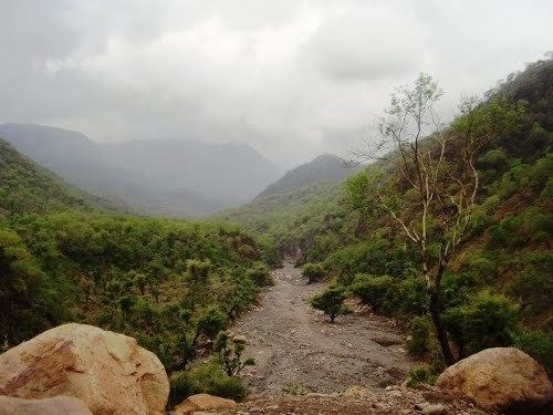
Along with Forêt du Day, the Mabla Mountains are one of Djibouti's two remnant areas of closed forest. The range is located in the Obock Region, 25 kilometres (16 mi) west of Obock, a port town. At 5,850 feet (1,780 m) above sea level, the mountains are situated behind the coastal plain where the Red Sea meets the Gulf of Aden. They lie on the northern side of the Gulf of Tadjoura, and are characterized as a highland region.
The mountains consist of a range that extends north from near Ras Duan, a steep cliff. Accolado Mount (Assasanto), 1,204 feet (367 m) above sea level, is the north mount of the east branch of the Mabla Mountains; it is located 6 miles (9.7 km) northwest of the Latela Valley entrance. Morne Rouge, 426 feet (130 m) above sea level, is 3 miles (4.8 km) north-northwest of the valley entrance. It has three round summits which are formed of reddish stones. Morne Blanc, 1 mile (1.6 km) west-southwestof Morne Rouge, is a cone of a greyish appearance. Pic du Hussard (Aramuda) 2,612 feet (796 m) high is 14 miles (23 km) north of Ras Duan; it has a large, rounded summit. Minerva's Face, 1.4 miles (2.3 km) south-southeast of Pic du Hussard has three summits, the highest of which is 2,392 feet (729 m) high. Devil's Chair, 4 miles (6.4 km) southeast of Minerva's Face, is 1,424 feet (434 m) high and clearly visible from seaward.
The annual rainfall measures approximately 20 inches (510 mm).
Culture
An Afar people subgroup, Ma`andiyta (or "White"; or Mandita) stayed in the Mabla Mountains, while the Ma`andiyta of Immino (or Awsa, or Aussa, or Assaw ; or "Red") did not. The Mandita are located west of the Mabla Mountains. Another Afar subgroup, the Debne, were settled in the Mabla also. Yet another tribe is the Basooma.
The dabou, a permanent stone dwelling, is found in certain high ground regions, such as the Mabla and Goda Mountains, as well as in Ethiopia with the Afar.
Flora and fauna
The endemic, critically endangered Djibouti francolin was first recorded here in 1985, with the nearby Forêt du Day being its only other location.
In the 1920s, the mountains were thickly covered with trees. The terrain includes box (Frais spp.) and acacias, as well as palm groves within ravines. Higher elevations of 1,300–1,600 metres (4,300–5,200 ft) are home to juniper forest that include tall arborescens Euphorbia, and flowering herbs such as Forget-me-not. Near the summit can be found ferns.
In recent years, the forest has been damaged severely, chiefly through forest fires, the grazing of cattle, the felling of its trees, as well as military requirements. In the 1980s, a proposal was made to establish a national park in the mountains' Goula Region.
Climate
Mabla Mountains enjoys a mild climate throughout the winter and moderately sunny summer.