
Founded 1923 Time zone PST (UTC+8) | District 2nd District Barangays Area 44.47 km² Local time Friday 6:15 AM | |
 | ||
Weather 22°C, Wind E at 14 km/h, 84% Humidity Points of interest Aguila Beach Resort, Aquaventure Reef Club Dive Res, Bambu Villa Resort, Aquaventure Reef Club, Monte Carlo Resort In | ||
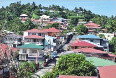
Mabini, officially the Municipality of Mabini (Filipino: Bayan ng Mabini), is a municipality in the province of Batangas in the Calabarzon (Region IV-A) of the Philippines. The population was 46,211 at the 2015 census. In the 2016 electoral roll, it had 28,259 registered voters.
Contents
- Map of Mabini Batangas Philippines
- Scuba diving in mabini batangas philippines by ordub
- History
- Geography
- Barangays
- Demographics
- Transportation
- Health
- Education
- Attractions
- References
Map of Mabini, Batangas, Philippines
Mabini is known for its diving and snorkeling sites. It is named after Apolinario Mabini, a Filipino revolutionary hero.
Scuba diving in mabini batangas philippines by ordub
History
Legend states that the first Malay settlers to inhabit the vast fertile land bordering the two bodies of water now known as the Batangas Bay and the Balayan Bay, first found anchor along the shores of the land protruding down Southwest ward known geographically as the Calumpan Peninsula.
These Malay settlers found the land fertile and agriculturally appropriate and the sea rich in marine resources. They established their settlement in this once vast unknown land. As more Malay settlers arrived from distant lands, more settlements were founded until even the upland regions of the peninsula were settled. The inhabitants had their own form of village government. They were ruled by a headman, a datu, or a sultan, in case of big encampments. Malay civilization began to take roots. Rapid increase of population brought about the settlements of all the neighboring regions, that it did not take long before several nearby regions were inhabited later on to comprise the whole province of Kumintang, better known later as Batangas.
During the Spanish colonial rule, the Calumpan Peninsula was made a part of the pueblo of Bauan, in the province of Kumintang. The same peninsula territory of Bauan was subdivided into barrios: Mainaga, Pulong-Niogan, Pulong-Balibaguhan, Anilao, Solo, Pulong-Anahao, Bagalangit, Nag-Iba, Malimatoc, Saguing and Talaga. For more than three hundred years, while the Archipelago was under Spanish domination, the peninsula remained a part of the “pueblo” of Bauan even until the early part of the American occupation. The people of this peninsula, like other people of other regions, suffered untold hardships under the Spanish rule. The yoke of the Spanish tyranny was thrown off after the gallant uprising of 1896. The revolution emancipated the people from the tyrants of Spain. Foremost of the heroic young men was Don Francisco Castillo, known as Apian Kiko, who led the fight for freedom in this peninsula.
After efforts had been exerted by the proponents of establishing a new municipality independent of the town of Bauan, eleven (11) barrios of the Calumpan Peninsula and the whole of the Maricaban Island was declared an independent municipality, with the name Mabini, derived from the Philippine hero Apolinario Mabini. The new-born municipality of Mabini was inaugurated on January 1, 1918, with Captain Francisco Castillo, known as the founder of the town, as the first appointive Municipal President.
Geography
Mabini is located at 13°43′N 120°54′E.
According to the Philippine Statistics Authority, the municipality has a land area of 44.47 square kilometres (17.17 sq mi) constituting 7000143000000000000♠1.43% of the 3,119.75-square-kilometre- (1,204.54 sq mi) total area of Batangas.
Barangays
Mabini is politically subdivided into 34 barangays. Barangay San Juan was formerly the sitios of Nag-ilong and Lugay in the barrio of Mainaga, constituted into a separate and independent barangay through Republic Act No. 212, approved June 1, 1948.
Demographics
In the 2015 census, Mabini had a population of 46,211. The population density was 1,000 inhabitants per square kilometre (2,600/sq mi).
In the 2016 electoral roll, it had 28,259 registered voters.
Transportation
Jeepneys and tricycles are the main means of transportation around the town. Currently, there are two piers that serve the area: Anilao Pier and Talaga Pier, mainly catering for motor bancas going to and from the nearby island-town of Tingloy.