
Length 40 km Bridges Pont-Saint-Martin | ||
 | ||
Main source Monte Rosa2,500 m (8,200 ft) | ||
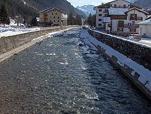
The Lys is a small 40 kilometres (25 mi) river (classified as a torrente) which flows from the Lys Glacier on the south side of the Monte Rosa massif, at the foot of Vincent Pyramid, elevation 4,215 metres (13,829 ft), and runs through the Val de Gressoney, flanked by a road, before converging with the Dora Baltea as a right tributary at Pont-Saint-Martin.
Map of Torrente Lys, Aosta Valley, Italy
Its left-side tributaries are Avant-Cir, Glassit, Loo, Mos, Niel, Pacoulla, and Tourrison. From the right it receives: Rû de Nantay, Stolen and Valbona.
References
Lys (Dora Baltea) Wikipedia(Text) CC BY-SA