
Founded 1861 Area 5,242 km² Unemployment rate 10.2% (Apr 2015) | Population 51,557 (2013) | |
 | ||
Rivers Carson River, Desert Creek, Green Creek, Rough Creek Points of interest | ||
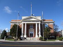
Lyon County is a county located in the U.S. state of Nevada. As of the 2010 census, the population was 51,980. Its county seat is Yerington.
Contents
- Map of Lyon County NV USA
- History
- Railroads
- Air
- Train
- Geography
- Adjacent counties and city
- 2000 census
- 2010 census
- Education
- Entertainment
- References
Map of Lyon County, NV, USA
Lyon County includes the Fernley, NV Micropolitan Statistical Area, which is part of the Reno-Carson City-Fernley, NV Combined Statistical Area.
History
Lyon County was one of the nine original counties created in 1861. It was named after Nathaniel Lyon, the first Union General to be killed in the Civil War. Its first county seat was established at Dayton on November 29, 1861, which had just changed its name from Nevada City in 1862, and which had been called Chinatown before that. After the Dayton Court House burned down in 1909, the seat was moved to Yerington in 1911. There were stories that it was named for Captain Robert Lyon, a survivor of the Pyramid Lake War in 1860, but Nevada State Archives staff discovered a county seal with the picture of the Civil War general, settling the conflict.
Railroads
The Central Pacific (the first transcontinental railroad) ran through the county, although a portion of the original route has been shifted for a new route south of Wadsworth in favor of Fernley. The Central Pacific later became the Southern Pacific Railroad which was merged into Union Pacific in 1996.
The Virginia and Truckee Railroad runs through Mound House in western Lyon County, on its way from Carson City to Virginia City.
The narrow-gauge Carson and Colorado Railroad had its terminus in Mound House, where it intersected with the V&T. It traveled east through Dayton, then turned south to the Mason Valley, and east again on its way to Walker Lake. Later a branch line connected the C&C to the Southern Pacific at Hazen.
The Eagle Salt Works Railroad ran for 13.5 miles, primarily on the original Central Pacific grade from Luva (2 miles east of Fernley) to Eagle Salt Works.
The Nevada Copper Belt Railroad ran on the west side of the Mason Valley.
Air
There are three public airports in Lyon County:
Train
The Amtrak passenger train California Zephyr passes through, but does not stop in Lyon County. The nearest Amtrak passenger stations are Reno and Winnemucca, Nevada. The California Zephyr runs from the San Francisco Bay Area to Chicago via Salt Lake City, Denver and Omaha.
Geography
According to the U.S. Census Bureau, the county has a total area of 2,024 square miles (5,240 km2), of which 2,001 square miles (5,180 km2) is land and 23 square miles (60 km2) (1.1%) is water. It is the third-smallest county in Nevada by area. The highest point is approximately 10,565 feet (3,220 m) on the northeast ridge of Middle Sister, who's peak is in adjacent Mono County, California, while the highest independent mountain completely within Lyon County is the nearby East Sister. The most topographically prominent peak in Lyon County is Bald Mountain.
Part of the Toiyabe National Forest is located within Lyon County.
Adjacent counties and city
2000 census
As of the census of 2000, there were 34,501 people, 13,007 households, and 9,443 families residing in the county. The population density was 17 people per square mile (7/km²). There were 14,279 housing units at an average density of 7 per square mile (3/km²). The racial makeup of the county was 88.62% White, 0.65% Black or African American, 2.45% Native American, 0.61% Asian, 0.14% Pacific Islander, 4.59% from other races, and 2.94% from two or more races. 10.97% of the population were Hispanic or Latino of any race (this figure likely doesn't reflect the significant illegal alien population).
There were 13,007 households out of which 33.20% had children under the age of 18 living with them, 58.40% were married couples living together, 9.10% had a female householder with no husband present, and 27.40% were non-families. 21.40% of all households were made up of individuals and 8.30% had someone living alone who was 65 years of age or older. The average household size was 2.61 and the average family size was 3.02.
In the county, the population was spread out with 27.10% under the age of 18, 6.60% from 18 to 24, 27.30% from 25 to 44, 25.20% from 45 to 64, and 13.70% who were 65 years of age or older. The median age was 38 years. For every 100 females there were 102.50 males. For every 100 females age 18 and over, there were 100.00 males.
The median income for a household in the county was $40,699, and the median income for a family was $44,887. Males had a median income of $34,034 versus $25,914 for females. The per capita income for the county was $18,543. About 7.20% of families and 10.40% of the population were below the poverty line, including 14.10% of those under age 18 and 7.10% of those age 65 or over.
From 2000 until 2008, Lyon County was one of the fastest-growing counties in the United States. However, its growth rate collapsed during 2008.
2010 census
As of the 2010 United States Census, there were 51,980 people, 19,808 households, and 14,137 families residing in the county. The population density was 26.0 inhabitants per square mile (10.0/km2). There were 22,547 housing units at an average density of 11.3 per square mile (4.4/km2). The racial makeup of the county was 85.0% white, 2.5% American Indian, 1.4% Asian, 0.8% black or African American, 0.3% Pacific islander, 6.4% from other races, and 3.7% from two or more races. Those of Hispanic or Latino origin made up 14.8% of the population. In terms of ancestry, 20.0% were German, 18.5% were English, 15.5% were Irish, 5.9% were Italian, and 5.3% were American.
Of the 19,808 households, 33.2% had children under the age of 18 living with them, 55.3% were married couples living together, 10.2% had a female householder with no husband present, 28.6% were non-families, and 22.1% of all households were made up of individuals. The average household size was 2.61 and the average family size was 3.02. The median age was 40.9 years.
The median income for a household in the county was $48,433 and the median income for a family was $56,106. Males had a median income of $45,319 versus $31,536 for females. The per capita income for the county was $21,041. About 8.7% of families and 12.8% of the population were below the poverty line, including 14.9% of those under age 18 and 6.6% of those age 65 or over.
Education
Lyon County has 16 schools provided by the Lyon County School District.
Entertainment
Prostitution is licensed and legalized in Lyon county. Open ranches include: