
 | ||
Similar Profiles | ||
Turkey hiking the lycian way
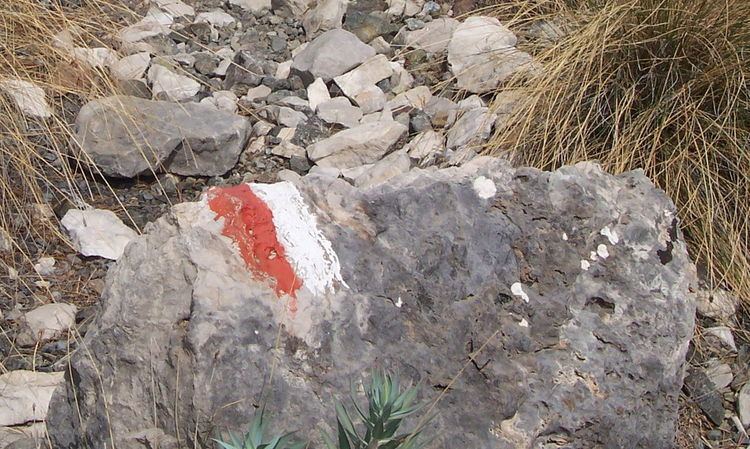
The Lycian Way is a long-distance footpath in Turkey around part of the coast of ancient Lycia. It is approximately 540 km long and stretches from Ölüdeniz, near Fethiye, to Geyikbayırı, about 20 kilometers from Antalya. It is waymarked with red and white stripes, the Grande Randonnee convention. The Sunday Times has listed it as one of the world's top ten walks.
Contents
It takes its name from the ancient civilisation, which once ruled the area.
Partial list of places on the trail
Places along the trail include:
Ölüdeniz, Faralya, Kabak, detour to Sidyma, Bel, Gavurağılı, Letoon, Kınık (Xanthos), Akbel, Gelemiş village and ruins of Patara), Kalkan, Sarıbelen, Gökçeören, Kaş (Antiphellos), Üçağız, Kale, Demre (Myra), Kumluca, Belören, Zeytin and Alakilise. Here the trail reaches a height of 1811 meters at İncegeriş T.. It continues to Belos, Finike, Kumluca, Mavikent, Karaöz, the southernmost point of Lycia at the lighthouse of Cape Gelidonya. Here it turns north to Adrasan, Olympos, and Çıralı.
Here the trail splits into:
- Coastal route: Tekirova, Phaselis, Asagikuzdere, Goynuk Yaylasi, Hısarçandır, Çitdibi, Geyikbayırı.
- Inland route: Ulupınar, Beycik, Yukari Beycik, pass over Tahtalı Dağı at 1800m, Yayla Kuzdere, Gedelme, Goynuk Yaylasi, where it joins the coastal trail.
Ultramarathon
Since 2010, an international multiday trail running ultramarathon, called Lycian Way Ultramarathon, is held on the historical way. The event runs eastwards on a route of around 220–240 km (140–150 mi) from Ölüdeniz to Antalya in six days.