
- elevation 655 m (2,149 ft) - average 30 m/s (1,059 cu ft/s) Discharge 30 m³/s Source Lusatian Mountains | - elevation 32 m (105 ft) Length 252 km Basin area 4,297 km² | |
 | ||
Bridges Altstadtbrücke, Neisseviadukt, English Bridge Countries Germany, Poland, Czech Republic | ||
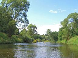
The Lusatian Neisse (Czech: Lužická Nisa; German: Lausitzer Neiße; Polish: Nysa Łużycka; Upper Sorbian: Łužiska Nysa; Lower Sorbian: Łužyska Nysa), or Western Neisse, is a 252-kilometre (157 mi) long river in Central Europe. It rises in the Jizera Mountains near Nová Ves nad Nisou, Czech Republic, reaching the tripoint with Poland and Germany at Zittau after 54 kilometres (34 mi), and later forming the Polish-German border for a length of 198 kilometres (123 mi). The Lusatian Neisse is a left-bank tributary of the river Oder, into which it flows between Neißemünde-Ratzdorf and Kosarzyn north of the towns of Guben and Gubin.
Contents
Map of Lusatian Neisse
According to the 1945 Potsdam Agreement in the aftermath of World War II, the river became part of the Polish western border with Germany (the Oder-Neisse line). Being the longest and most notable of the three rivers named Neisse (Neiße) (German) or Nysa (Polish) (the two other rivers being the Eastern Neisse (Polish: Nysa Kłodzka; German: Glatzer Neisse) and Raging Neisse (Polish: Nysa Szalona; German: Wütende Neiße or Jauersche Neiße)), it is simply referred to as the Neisse.
NameEdit
Since the river runs through the historic region of Lusatia, the adjective "Lusatian" or "Western" before the name of the river Neisse is used whenever differentiating this border river from the Eastern Neisse (Polish: Nysa Kłodzka, German: Glatzer Neisse) and the smaller Raging Neisse (Polish: Nysa Szalona; German: Wütende Neisse or Jauersche Neisse), both in Poland.
Towns and villagesEdit
At Bad Muskau the Neisse flows through Muskau Park, a UNESCO World Heritage Site. Cities and towns on the river from source to mouth include:
TributariesEdit
Right bank:
Left bank: