
Area 15.28 km² | Canton Orgères-en-Beauce Population (2008) 187 | |
 | ||
Lumeau is a commune in the Eure-et-Loir department in northern France, between Chartres and Orléans.
Contents
Map of 28140 Lumeau, France
Geography
Lumeau is situated in the Beauce agricultural plain, 34 km north from Orléans, 39 km north-east from Châteaudun, 50 km south of Chartres and 111 km south of Paris.
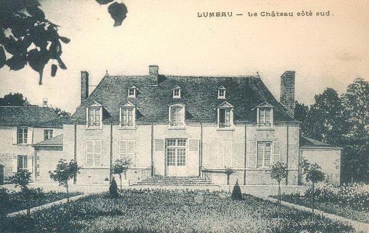
History
Lumeau has roots as a Gaulish village in the Carnutes territory. It was inhabited long before Roman times. Lumeau name derives from the Gallic elm (Ulmus) and is of Celtic origin. It is crossed by an old Roman road. It is cited in an Act of Charles the Bald (about AD 877).
In 1963, in Neuvilliers hamlet of Lumeau, a tomb was discovered, including a gallery and a circular room dated 12th century, which are certainly a part of a very important network dating from the Middle Ages.
During the Hundred Years' War, especially in 1361, the British occupied the nearby castle.
From 1785 to 1792 isolated farms suffered attacks from a criminal gang referred to as the 'Chauffeurs d'Orgères' (burners from Orgères).
During the Franco-Prussian War of 1870, Lumeau is in the middle of the Loigny-Poupry battlefield, between the French Armée de la Loire and the Bavarian and Prussian troops. The battle spread over the municipalities of Guillonville, Loigny, Lumeau and Poupry on 2 December 1870. Lumeau is mainly involved in combat events from November 29 to December 3, 1870, while further rescue activities take place from December 2, 1870 to February 18, 1871. A memorial was built in 1873 in Neuvilliers hamlet where French troop stationed : this is a white obelisk with a height of eight meters over an ossuary (containing thousands human remains) under a granite basement surrounded by a chain.
Transport
The distances between Lumeau and its neighbouring towns is as follows: