
Population 1,180 (2011 Census) Local time Tuesday 6:00 AM District Swale | Sovereign state United Kingdom Postcode district ME9 Dialling code 01795 | |
 | ||
Weather 7°C, Wind SW at 14 km/h, 97% Humidity | ||
The saxon shore way lower halstow to swale 23 august 2016
Lower Halstow is a village and civil parish in the Swale district of Kent, England. The village is situated to the north west of Sittingbourne on the banks of the Medway Estuary. It lies north of Newington on the A2 Roman road.
Contents
- The saxon shore way lower halstow to swale 23 august 2016
- Map of Lower Halstow Sittingbourne UK
- Edith may lower halstow kent
- Etymology
- Church
- References
Map of Lower Halstow, Sittingbourne, UK
The village has a long and interesting history, with evidence of constant occupation since the Iron Age. Being so close to the water, Lower Halstow has (until recently) been a village that has made its living from the water. Whether it be ancient pottery making, ancient fishing, barge building, or in the 19th- and 20th-century brick-making (Eastwoods Brickworks), the water has been the lifeblood of the village.
According to Edward Hasted in 1798, two large hospital ships, commonly called lazarettos, (which were the surviving hulks of forty-four gun ships) were moored in Halstow Creek. The lazarettos monitored ships coming to England which were forced to stay in the creek under quarantine, to protect the country from infectious diseases.
In 1563, Queen Elizabeth ordered a survey, and Halstow Key (a wharf on the creek), was made up of 24 people in houses and 14 living on boats. There were two hamlets, one beside the wharf and the other around Halstow Green on Lower Street. The rest of the northern lands were salt marsh. Lands heading southwards (measuring 1200 acres) were heavy clay. All the lands were under the control of the manor of Milton Regis.
In 2011, the population of the village was 1,180.
Edith may lower halstow kent
Etymology
The name of the village has developed gradually over the years: Holy Place (Halig stow) Pronounced "ail-stoo", with a long "oo" as in "through" c. 1100; Halgastaw, 1160; Halgastow, 1199; Halegestowe, 1226; Halgesto, 1576; Halstowe, 1610; Halstoe, c. 1790; Halstow, 1810 – Lower Halstow.
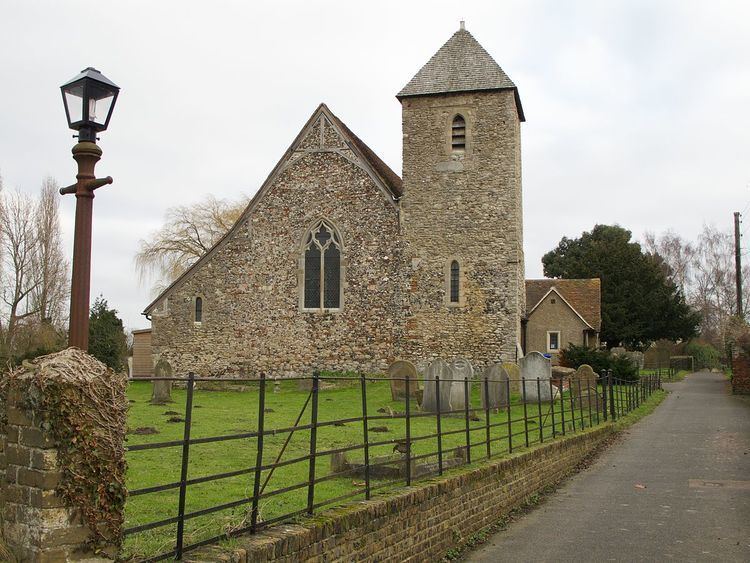
Church
On the banks of the Medway Estuary is the church of St Margaret of Antioch. This Grade II listed church has a long history that can be traced back to Saxon times. It is in the diocese of Canterbury, and deanery of Sittingbourne. The first recorded parish priest was John de London who was a nephew to St Thomas Becket.
The church has features and ancient artifacts that are still in use today. The church can trace its oldest parts back to the 7th century, making it one of the oldest churches still in use in England. Some points of interest are: