
Principal city Louisville Urban area 1,236 km² | Time zone EST (UTC-5) | |
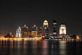 | ||
The Louisville/Jefferson County, KY–IN Metropolitan Statistical Area, commonly called the Louisville metropolitan area or Kentuckiana, is the 43rd largest Metropolitan Statistical Area (MSA) in the United States. The primary city is Louisville, Kentucky.
Contents
- Map of Louisville USA
- Definitions
- Counties
- Municipalities
- Metropolitan Statistical Area
- Combined Statistical Area
- References
Map of Louisville, USA
It was originally formed by the United States Census Bureau in 1950 and consisted of the Kentucky county of Jefferson and the Indiana counties of Clark and Floyd. As surrounding counties saw an increase in their population densities and the number of their residents employed within Jefferson County, they met Census criteria to be added to the MSA. Jefferson County, Kentucky (contiguous with Louisville Metro), plus twelve outlying counties – seven in Kentucky and five in Southern Indiana – are now a part of this MSA. One other Kentucky county was part of the MSA in the 2000 and 2010 U.S. Censuses, but was spun off by the Census Bureau into its own Micropolitan Statistical Area in 2013.
People living in any of the MSA are said to be living in the Louisville/Jefferson County Area. Because it includes counties in Indiana, the MSA (or a large portion thereof) is regularly referred to as Kentuckiana. It is now the primary MSA of the Louisville/Jefferson County–Elizabethtown–Madison, KY–IN Combined Statistical Area (or Louisville CSA, which adds Hardin County, Kentucky, LaRue County, Kentucky, Jefferson County, Indiana, and Nelson County, Kentucky). The combined statistical area created by the United States Bureau of the Census in 2000 and most recently redefined in 2013 comprises the Louisville/Jefferson County, KY–IN Metropolitan Statistical Area (MSA), the Elizabethtown-Fort Knox, KY Metropolitan Statistical Area, the Bardstown, KY Micropolitan Statistical Area and the Madison, IN Micropolitan Statistical Area (also abbreviated as MSA).
Definitions
As of 2013 the U.S. Office of Management and Budget defines the Louisville/Jefferson County, KY-IN Metropolitan Statistical Area as including Bullitt, Henry, Jefferson, Meade, Oldham, Shelby, and Trimble Counties in Kentucky and Clark, Floyd, Harrison, Scott, and Washington Counties in Indiana. The larger Louisville/Jefferson County–Elizabethtown–Madison, KY–IN Combined Statistical Area adds two other statistical areas in Kentucky and one in Indiana:
Counties
Louisville/Jefferson County, KY-IN MSA
Elizabethtown–Fort Knox, KY MSA
Bardstown, KY µSA
Madison, IN µSA
Municipalities
Principal city
In 2003, the Jefferson government merged with that of its largest city and county seat, Louisville, forming a new entity, the Louisville/Jefferson County Metro Government (official long form) or Louisville Metro (official short form). All small cities within Jefferson became part of the new Louisville Metro government while retaining their city governments. For statistical and ranking purposes, the United States Census Bureau uses the statistical entity Louisville/Jefferson County (balance), Kentucky to represent the portion of the consolidated city-county of Louisville/Jefferson County that does not include any of the 83 separate incorporated places (municipalities) located within the city and county.
Louisville Metro (756,832)
Louisville/Jefferson County (balance) (609,893)
Municipalities with more than 25,000 people
Municipalities with 10,000 to 25,000 people
Municipalities with less than 10,000 people
*Part of Louisville Metro
‡Prospect lies in both Jefferson and Oldham Counties. The portion within Jefferson County is part of Louisville Metro.
Metropolitan Statistical Area
Notes
Combined Statistical Area
Notes