
 | ||
Louhajang River (Bengali: লৌহজং নদী [lowɦɔdʒɔŋ nɔd̪i]) is located in central Bangladesh. It branches out from the Jamuna near Gabsain at Bhuapur, Tangail District. Thereafter it splits into two parts before the parts meet up again. It flows past Tangail city, Karotia and Jamurki before joining the Bangshi Louhajang is linked with the Dhaleshwari
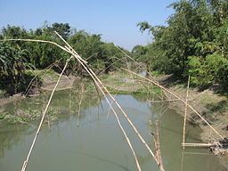
The average depth is 1 metre (3 ft) and maximum depth is 3 metres (9 ft).
Until around the 1980s, launches and big boats carrying merchandise anchored at Tangail. A road at College Para in the town was named "Amghat" as mangoes from Rajshahi were unloaded there. Besides, the river linked shoals in the western part with rest of the district. The river started dying after the Water Development Board constructed a sluice gate near the confluence of Louhajang and Dhaleshwari rivers in 1992 under its Flood Action Plan-20. Boats stopped plying the route since then as the river lost navigability. In the subsequent years, encroachment of its banks and shore areas increased.