
- elevation 2,080 ft (634 m) | - elevation 164 ft (50 m) | |
 | ||
- right Buckeye Creek (East Fork Los Trancos Creek) Cities | ||
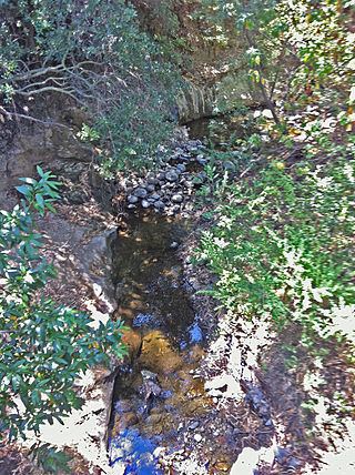
Los Trancos Creek (meaning "barriers" or "cattle guards" from the Spanish "Las Trancas") is a creek that flows northerly from Monte Bello Ridge on the northeast slope of the Santa Cruz Mountains to its confluence with San Francisquito Creek at Stanford University in California, United States of America. The creek forms the boundary between northwestern Santa Clara County and southeastern San Mateo County.
Contents
Map of Los Trancos Creek, California, USA
WatershedEdit
Los Trancos Creek drains an area of about seven square miles and consists of about 6.6 miles (10.6 km) of channel. Its headwaters are protected by the Los Trancos Open Space Preserve just northwest of Page Mill Road. The next watershed to the west is Corte Madera Creek, another tributary of San Francisquito Creek. The confluence of Los Trancos Creek with San Francisquito Creek occurs just below Piers Lane Road (between Interstate 280 and the Stanford Golf Course) in a small residential island of land belonging to Menlo Park within Stanford's lands.
EcologyEdit
In 1929 Stanford installed a diversion dam on Los Trancos Creek to its Felt Lake water storage reservoir. The dam, located just below the intersection of Arastradero and Alpine Roads, blocked access of anadromous Steelhead trout (Oncorhynchus mykiss) to over 3 miles (4.8 km) of pristine upstream spawning grounds. In 2009, Stanford University completed construction of a new fish screen and ladder as the previous fish ladder was an "Alaska Steep Pass" designed for much higher flows. The upper watershed is wholly protected within the Los Trancos Open Space Preserve just northwest of Page Mill Road and east of Skyline Boulevard. Spawning steelhead in Los Trancos Creek below the Felt Lake diversion dam vary from zero in drought years to several hundreds in wetter years and occurs from February to April. Steelhead spend two years in freshwater before heading to the Bay and field studies in the Stanford portion of Los Trancos Creek have found hundreds of young trout ranging from ~140 per mile to nearly 600 per mile.
HikingEdit
Excellent hiking from the Piers Lane parking area on Alpine Road crosses over San Franciscquito Creek and Los Trancos Creek just above their confluence and proceeds to the Stanford Dish. It is open from sunrise to sunset and no bicycles or dogs are allowed.
The headwaters of Los Trancos Creek are easily accessed from Page Mill Road in the Los Trancos Open Space Preserve of the Midpeninsula Regional Open Space District and include the Lost Creek Trail, the San Andreas Fault Trail, the Page Mill Trail and Los Trancos Trail.