
Country United States County San Mateo Elevation 459 ft (140 m) Zip code 94028 Local time Friday 10:38 AM | State California Incorporated July 14, 1964 Time zone PST (UTC-8) Population 4,518 (2013) Area code 650 | |
 | ||
Weather 12°C, Wind S at 27 km/h, 82% Humidity | ||
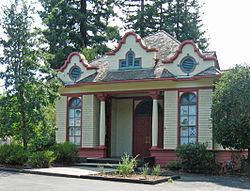
Alpine road in portola valley california
Portola Valley is an incorporated town in San Mateo County, California, United States. It is one of the wealthiest ZIP codes in the United States, with a median home price of $4,339,923 in 2013. The population was 4,353 at the 2010 census.
Contents
- Alpine road in portola valley california
- Map of Portola Valley CA USA
- History
- Geography
- Local Attractions
- 2010
- 2000
- Education
- Government
- Notable people
- References
Map of Portola Valley, CA, USA
Portola Valley is one of the forty wealthiest towns in the United States, with a median household income of $244,771 a year. Within the State of California, Portola Valley is ranked as the sixth wealthiest place. The zip code 94028, which encompasses the whole of Portola Valley, has the 9th most expensive housing prices within the country according to Forbes Magazine 2013.
History
Portola Valley was named for Spanish explorer Gaspar de Portolá, who led the first party of Europeans to explore the San Francisco Peninsula in 1769. The town was officially incorporated in 1964. The town's long history dates back to 1834, when land was used for the Rancho Corte de Madera primarily for cattle grazing. Another place of interest within the town was the Searsville area (now owned by Stanford). Searsville's redwood trees were logged and used for building housing. Evidence of logging can be seen by walking through the preserve and examining the abnormal redwood growth from where the trees used to stand. Today, Portola Valley maintains its small-town charm and rural feel with a population of under 5,000 people, as well as boasting to have more miles of trails than roads to preserve its natural beauty.
Portola Valley has also been included many times on lists of America's wealthiest ZIP codes. Initially, Portola Valley was an exclusive vacation community for wealthy San Franciscans who would make trips down during the summer in horse and buggy. It kept growing and eventually became central to the tech industry and Silicon Valley as an alternative to the hustle and bustle of more crowded cities, providing a quiet rural refuge directly in the heart of the Peninsula for over 4,000 residents.
Portola Valley is Featured in:
Geography
Portola Valley is located at 37°22′30″N 122°13′7″W (37.375023, -122.218635), on the eastern slope of the Peninsula Coastal Range of the Santa Cruz Mountains. The Windy Hill Open Space Preserve is on the town's southwest side and the Jasper Ridge Biological Preserve is on the north side of town. It is off Interstate 280, near Woodside, just west of Palo Alto and Los Altos and south of Menlo Park, and is in a mostly wooded area, with some open plains.
Portola Valley can generally be divided into 5 subdivisions: Central Portola Valley, The Ranch, Corte Madera, Los Trancos/Vista Verde, and Blue Oaks.
According to the United States Census Bureau, the town has a total area of 9.1 square miles (24 km2), 99.98% of it land and 0.02% of it water.
Local Attractions
2010
The 2010 United States Census reported that Portola Valley had a population of 4,353. The population density was 478.7 people per square mile (184.8/km²). The racial makeup of Portola Valley was 3,960 (91.0%) White, 12 (0.3%) African American, 5 (0.1%) Native American, 242 (5.6%) Asian, 1 (0.0%) Pacific Islander, 29 (0.7%) from other races, and 104 (2.4%) from two or more races. Hispanic or Latino of any race were 175 persons (4.0%).
The Census reported that 4,309 people (99.0% of the population) lived in households, 9 (0.2%) lived in non-institutionalized group quarters, and 35 (0.8%) were institutionalized.
There were 1,746 households, out of which 518 (29.7%) had children under the age of 18 living in them, 1,149 (65.8%) were opposite-sex married couples living together, 70 (4.0%) had a female householder with no husband present, 35 (2.0%) had a male householder with no wife present. There were 37 (2.1%) unmarried opposite-sex partnerships, and 21 (1.2%) same-sex married couples or partnerships. 420 households (24.1%) were made up of individuals and 290 (16.6%) had someone living alone who was 65 years of age or older. The average household size was 2.47. There were 1,254 families (71.8% of all households); the average family size was 2.93.
The population was spread out with 1,001 people (23.0%) under the age of 18, 145 people (3.3%) aged 18 to 24, 538 people (12.4%) aged 25 to 44, 1,496 people (34.4%) aged 45 to 64, and 1,173 people (26.9%) who were 65 years of age or older. The median age was 51.3 years. For every 100 females there were 98.4 males. For every 100 females age 18 and over, there were 91.2 males.
There were 1,895 housing units at an average density of 208.4 per square mile (80.5/km²), of which 1,392 (79.7%) were owner-occupied, and 354 (20.3%) were occupied by renters. The homeowner vacancy rate was 1.0%; the rental vacancy rate was 9.8%. 3,702 people (85.0% of the population) lived in owner-occupied housing units and 607 people (13.9%) lived in rental housing units.
2000
As of the census of 2000, there were 4,392 people, 1,772 households, and 1,269 families residing in the town. The population density was 487.5 people per square mile (188.3/km²). There were 1,772 housing units at an average density of 193.6 per square mile (74.8/km²). The racial makeup of the town was 4,210 White, 29 African American, 22 Native American, 217 Asian, 5 Pacific Islander, 54 from other races, and 64 from two or more races. Hispanic or Latino of any race were 149.
There were 1,772 households out of which 532 had children under the age of 18 living with them, 1,176 were married couples living together, 68 had a woman householder with no man present, and 431 were non-families. 339 of all households were made up of individuals and 226 had someone living alone who was 65 years of age or older. The average household size was 2.75 and the average family size was 2.93.
In the town the age distribution of the population shows 1021 persons under the age of 18, 90 from 20 to 24, 867 from 25 to 44, 1492 from 45 to 64, and 938 who were 65 years of age or older. The median age was 47.5 years old. For every 100 women there were 96.8 men. For every 100 women age 18 and over, there were 91.7 men.
The median income for a household in Portola Valley, including earnings, is $244,771 and the median income for a family was $180,893. Men have a median income of over $100,000 versus $92,585 for women. The per capita income for Portola Valley is $99,621. About 18 families and 104 people were below the poverty line, including 38 of those under age 18 and none of those age 65 or over.
Education
The Portola Valley Elementary School District has two public primary schools: Ormondale School (with grades K-3) and Corte Madera School (grades 4-8). Portola Valley is one of the few (perhaps only) school districts that has a school named after a race horse (Ormonde).
Portola Valley is also home to a Roman Catholic Benedictine monastery and an independent college-preparatory Roman Catholic day and boarding school, Woodside Priory School, with grades 6-12.
The nearest public secondary school is Woodside High School, located in neighboring Woodside. Many children attend other public and private institutions such as Woodside Priory School (located within the town limits of Portola Valley), Menlo-Atherton High School, Summit Preparatory Charter High School, Everest Public High School, Saint Francis High School (Mountain View), Menlo School, Sacred Heart Preparatory (Atherton, California), Junípero Serra High School, and Crystal Springs Uplands School.
The city is served by the Portola Valley Public Library of the San Mateo County Libraries, a member of the Peninsula Library System.
Government
In the California State Legislature, Portola Valley is in the 13th Senate District, represented by Democrat Jerry Hill, and in the 24th Assembly District, represented by Democrat Marc Berman.
Federally, Portola Valley is in California's 18th congressional district, represented by Democrat Anna Eshoo.