
Surface area 4,360 acres (17.6 km) Surface elevation 284 m Mean depth 32 m | Basin countries United States Max depth 71 m Area 17.64 km² | |
 | ||
Primary inflows Catchment area 991 square miles (2,570 km) Outflow location Middle Fork Willamette River | ||
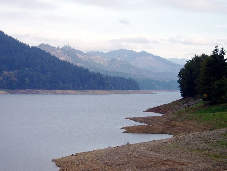
Lookout Point Lake (also Lookout Point Reservoir) is a large reservoir on the Middle Fork Willamette River in Lane County, Oregon, United States. It was created in 1953 with the construction of Lookout Point Dam.
Contents
Map of Lookout Point Lake, Oregon 97452, USA
The downstream end of the reservoir is about 20 miles (32 km) southeast of Eugene. It lies immediately upriver from Dexter Lake, another reservoir. The city of Lowell is nearby, along the north shore of Dexter Lake. Oregon Route 58 follows the lake's southern shore and Boundary Road the northern shore. The lake, about 10 miles (16 km) long, continues upriver to within about 7 miles (11 km) of Oakridge.
Lookout Point Dam, 276 feet (84 m) high, impounds up to 477,700 acre feet (589,200,000 m3) of water. It helps control flooding, generates electricity, and provides a place for boating and other outdoor recreation.
HistoryEdit
The two reservoirs, Lookout Point and Dexter, were created in the early 1950s, when the United States Army Corps of Engineers finished building the dams that contain them. Dexter exists partly as a re-regulating basin that controls water surges from Lookout Point Lake. The pair of dams work together to prevent downstream flooding.
Both dams are equipped with powerhouses that generate electricity. Lookout Point Dam has three generating units that can produce a combined 120,000 kilowatts of power. Water levels in the dam are usually high from May through August. To supply demands for water downriver, a gradual drawdown of lake water begins in July and extends through September. After September, the lake is emptied more rapidly to make room for high river flows that enter the lake during the winter. The Lookout Point and Dexter projects are among 13 built by the Corps in the Willamette Valley.
RecreationEdit
Recreation on or near the lake includes boating and fishing, camping and picnicking. Large populations of rough fish such as northern pikeminnows and suckers limit the catch of fish such as rainbow trout considered desirable by sports fishers. Strong winds, big waves, and annual fluctuations in the lake level also make fishing more difficult.
Several picnicking and boat launches run by the county, the state, or the Willamette National Forest are located around the lake. Some of the ramps become disconnected from the lake when the water is low, but the ramps near Lowell and the dam remain operational all year. Camping spots are available at Black Canyon Campground, managed by the United States Forest Service, near the southeast end of the lake.