Elevation 408 m | Prominence 305 m | |
 | ||
Similar Stiperstones, Corndon Hill, Caer Caradoc, Brown Clee Hill, Hergest Ridge | ||
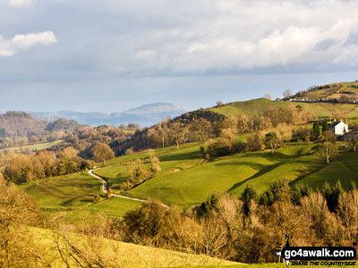
Long Mountain (Welsh: Cefn Digoll) is a hill located east of Welshpool in Powys, Wales. It crosses the national boundaries of England and Wales, and also the county boundaries of Powys and Shropshire.
Contents
Map of Long Mountain, Welshpool, UK
It is a Marilyn (a hill with topographic prominence of at least 150 metres), having a prominence of 305 metres (1,000 feet).
It rises to a height of 408 metres (1,339 feet) at Beacon Ring, where there is a hillfort.
LocationEdit
Long Mountain extends from Forden, Powys, in the southwest to Vennington near Westbury in Shropshire to the northeast. It is sometimes considered to include the Breidden Hills to the north although the latter are separated from Long Mountain's main body by a valley through which run a railway line and a major trunk road (the A458) connecting Welshpool with Shrewsbury.
HistoryEdit
There was a Roman road along Long Mountain, part of a route from Uriconium (Wroxeter) to Lavobrinta (Forden Gaer). At the southern end of the hill there are traces of Offa's Dyke, and the Offa's Dyke Path traverses the Welsh area of the hill. Within the English area, in Long Mountain's eastern foothills, are the remains of Caus Castle, which was built in Norman times upon an earlier, Iron Age, hillfort.
In 630 the hill was the scene of the Battle of Cefn Digoll, between Northumbria and an alliance of Gwynedd and Mercia.
