
OS grid reference SO415038 Country Wales Postcode district NP15 Local time Thursday 10:54 AM | Sovereign state United Kingdom Dialling code 01291 | |
 | ||
Weather 7°C, Wind NE at 26 km/h, 87% Humidity | ||
Llandenny (Welsh: Llandenni or, lesser used, Mathenni) is a village in Monmouthshire, south east Wales, United Kingdom. Llandenny is located three miles south of Raglan and three miles north of Usk.
Contents
Map of Llandenny, Usk, UK
History and amenities
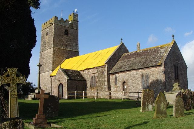
The little village of Llandenny is just a few houses, a pub (the Raglan Arms) and the Church of St John, named after St John the Apostle and Evangelist. The main south Wales to the Midlands road link, the A449, passes close to the village.
The Raglan Arms was promoted by Lord Raglan who owned, as the family still does, the large estate nearby. A landlord of the pub in the 1930s was Frank Wake who catered nearly always for the farm labourers and not the gentry so it became a 'thorn in the flesh' of the Raglan family.
The nearby Llandenny railway station building still exists though half demolished. It includes a ground frame signal box on the platform, a cattle dock and small goods sidings. It stood on the Coleford, Monmouth, Usk and Pontypool Railway line and closed in 1959.