
Country United States Time zone CST (UTC-6) Elevation 172 m Local time Thursday 12:45 AM | Established November 6, 1849 ZIP codes 61520, 61542, 61543 Area 109 km² Population 544 (2010) | |
 | ||
Weather 2°C, Wind E at 18 km/h, 59% Humidity | ||
Liverpool Township is one of twenty-six townships in Fulton County, Illinois, USA. As of the 2010 census, its population was 544 and it contained 255 housing units.
Contents
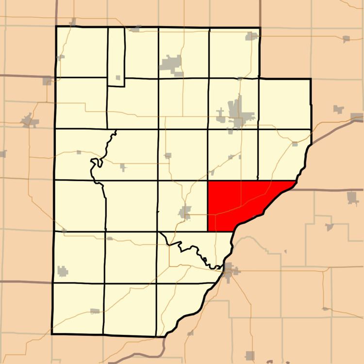
- Map of Liverpool Township IL USA
- Geography
- Cities towns villages
- Unincorporated towns
- Extinct towns
- Cemeteries
- Major highways
- Lakes
- School districts
- Political districts
- References
Map of Liverpool Township, IL, USA
Geography
According to the 2010 census, the township has a total area of 42.08 square miles (109.0 km2), of which 40.25 square miles (104.2 km2) (or 95.65%) is land and 1.83 square miles (4.7 km2) (or 4.35%) is water.
Cities, towns, villages
Unincorporated towns
(This list is based on USGS data and may include former settlements.)
Extinct towns
Cemeteries
The township contains these four cemeteries: Liverpool, Mount Pleasant, Pollitt and Salem.
Major highways
Lakes
School districts
Political districts
References
Liverpool Township, Fulton County, Illinois Wikipedia(Text) CC BY-SA