
Country United States of America | ||
 | ||
River mouth Confluence with Big Thompson4,724 ft (1,440 m) Progression | ||
The Little Thompson River is a tributary of the Big Thompson River and thence the South Platte River in the U.S. state of Colorado.
Map of Little Thompson River, Colorado, USA
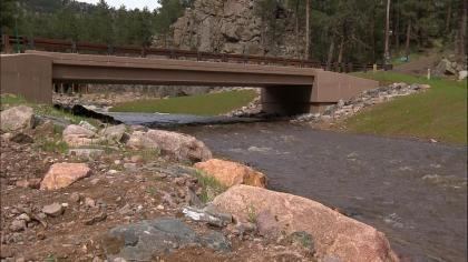
The river's headwaters lie in the Roosevelt National Forest. It flows east through the foothills of the Rocky Mountains in Larimer County through the town of Berthoud, Colorado, between Longmont to the south and Loveland to the north. The Little Thompson joins the Big Thompson River near that river's confluence with the South Platte River, near the town of Greeley, Colorado.
The Little Thompson runs 51.5 miles (82.9 km) from its headwaters to the confluence with the Big Thompson, and descends approximately 2,500 feet (760 m) in elevation in its approximately 24-mile (39 km) course through the mountains. Its run includes at least one 15-foot (4.6 m) waterfall and numerous granite box canyons. The river had no man-made dams as of 2007. It is managed as part of the Colorado-Big Thompson project.
The river is considered a Class IV+ waterway, marginally navigable by experienced kayakers, and then only when it is in flood stage during the rainy Spring season.
The most numerous fish species observed in the river include brook trout, mountain whitefish, rainbow trout, native Greenback cutthroat trout, and sculpin.