
Discharge 2.053 m³/s | - elevation 11,310 ft (3,447 m) - elevation 4,670 ft (1,423 m) Length 126 km | |
 | ||
- left North Fork Big Thompson River - average 72.5 cu ft/s (2.05 m/s) Cities | ||
Big thompson river colorado winter fly fishing
The Big Thompson River is a tributary of the South Platte River, approximately 78 miles (123 km) long, in the U.S. state of Colorado.
Contents
- Big thompson river colorado winter fly fishing
- Map of Big Thompson River Colorado USA
- Welcome to riverview rv park along the big thompson river in loveland colorado
- Course of the riverEdit
- 1976 floodEdit
- References
Map of Big Thompson River, Colorado, USA
Welcome to riverview rv park along the big thompson river in loveland colorado
Course of the riverEdit
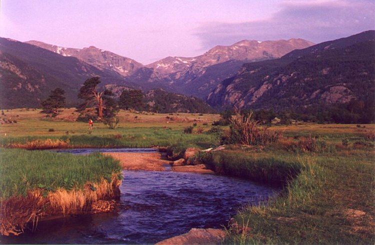
The headwaters of the Big Thompson River begin in Forest Canyon within Rocky Mountain National Park in Larimer County, Colorado. The river flows east through Moraine Park to the town of Estes Park. There it is held in Lake Estes by the Olympus Dam before being released into the Big Thompson Canyon. The North Fork Big Thompson River also begins in Rocky Mountain National Park, on the northern slopes of the Mummy Range. This tributary flows east, through the town of Glen Haven, where it merges with the Big Thompson River in the town of Drake, in the Big Thompson Canyon.
From Lake Estes, the river descends 1/2 mile (800 m) in elevation through the mountains in the spectacular 25 mi (40 km) Big Thompson Canyon, emerging from the foothills west of Loveland. It flows eastward, south of Loveland across the plains into Weld County and joins the South Platte approximately 5 mi (8 km) south of Greeley. It receives the Little Thompson River approximately four mi (6 km) upstream from its mouth.
Water resources in the Big Thompson River are managed by the Northern Colorado Water Conservancy District as part of the Colorado-Big Thompson Project.
1976 floodEdit
On July 31, 1976, during the celebration of Colorado's centennial, the Big Thompson Canyon was the site of a devastating flash flood that swept down the steep and narrow canyon, claiming the lives of 143 people, 5 of whom were never found. This flood was triggered by a nearly stationary thunderstorm near the upper section of the canyon that dumped 300 millimeters (12 inches) of rain in less than 4 hours (more than 3/4 of the average annual rainfall for the area). Little rain fell over the lower section of the canyon, where many of the victims were.
Around 9 p.m., a wall of water more than 6 meters (20 ft) high raced down the canyon at about 6 m/s (14 mph), destroying 400 cars, 418 houses and 52 businesses and washing out most of U.S. Route 34. This flood was more than 4 times as strong as any in the 112-year record available in 1976, with a discharge of 1,000 cubic meters per second (35,000 ft³/s).
In 2008, a man who was thought to have died in the flood was found to be alive and living in Oklahoma. Daryle Johnson and his family had rented a cabin east of Estes Park, but left without telling anyone on the morning of July 31. A woman who was researching the flood's victims discovered he was still alive.