
OS grid reference SK163785 Post town BUXTON Dialling code 01298 | Sovereign state United Kingdom Postcode district SK17 | |
 | ||
Peak district motorcycle trail riding ttr 250 from little hucklow to great hucklow 22 05 2015
The parish of Little Hucklow is situated in north Derbyshire. Whilst it is a separate civil parish in the Derbyshire Dales District, the Parish Council is joint with Great Hucklow, and Grindlow. The parish consists of the village of Little Hucklow and the hamlets of Coplow Dale and Windmill. The population of the parish is about 120 reducing to less than 100 at the 2011 Census. The population is now included in the civil parish of Great Hucklow. It lies within the Peak District National Park, under Hucklow Edge. The neighbouring villages are Bradwell, Derbyshire to the north, Great Hucklow to the east and Tideswell to the south. The village lies just west of the B6049 about a mile and a half north of where it crosses the A623 at the Anchor Inn. The village is linear and is aligned east-west.
Contents
- Peak district motorcycle trail riding ttr 250 from little hucklow to great hucklow 22 05 2015
- Map of Little Hucklow Buxton UK
- References
Map of Little Hucklow, Buxton, UK
The parish is highly rural with current farming activitiy being mainly livestock rearing. There was formerly considerable lead mining activity in the parish, including a 600-foot-deep (180 m) shaft at High Rake mine. The mine is situated on a large vein about a quarter of a mile west of the hamlet of Windmill in the Liberty of Little Hucklow. This vein is known under different titles as it ranges from the Sir William Hill on the east to beyond Tideslow Top on the west. At High Rake shaft it is called the High Rake, but immediately west of the old Tideswell to Castleton road it is known as Tideslow Rake and past Tideslow Top as White Rake. Eastwardly and beyond Windmill it is called the Hucklow Edge Vein. The foundations of the mine buildings have been excavated by the Peak District Historical Mines Society.
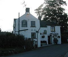
Windmill is a small hamlet in the parish of Little Hucklow, consisting of fifteen houses, and several farms. It is located on the lane that runs west from Windmill Triangle to the Old Castleton Road. There are a number of old houses, one of which was formerly a public house, and the other the village shop and cafe.