Neha Patil (Editor)

List of Pittsburgh neighborhoods

Updated on
Edit
Like
Comment
Share on FacebookTweet on TwitterShare on LinkedInShare on Reddit
List of Pittsburgh neighborhoods

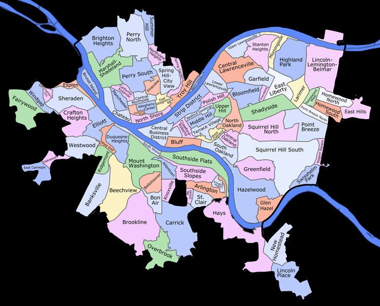
This is a list of neighborhoods in the city of Pittsburgh, Pennsylvania. Generally neighborhood development followed ward boundaries, although the City Planning Commission has defined some neighborhood areas. The map of neighborhoods presented here is based on the official designations from the City of Pittsburgh.

Contents

Map of Pittsburgh, PA, USA

Areas

  • Hazelwood
  • Hill District
  • Homewood
  • Lawrenceville
  • North Side
  • Oakland
  • South Side
  • Squirrel Hill
  • West End
  • List of municipalities annexed

  • Pitt, Peebles, Liberty, Collins and Oakland
  • Twps. in 1868

  • South Pittsburgh, Monongahela, Allentown, St. Clair, Lawrenceville, Temperanceville, Birmingham, Sligo, Mount Washington, West Pittsburgh and Ormsby in 1872
  • Garfield in 1881
  • Brushton in 1894
  • Beltzhoover in 1897
  • Esplen and Sterrett Twp. in 1906
  • Allegheny in 1907
  • Beechview and West Liberty in 1908
  • Lower St. Clair Township in 1924
  • Carrick, Knoxville, and Westwood in 1927
  • Overbrook in 1930
  • References

    List of Pittsburgh neighborhoods Wikipedia