
Country United States County Lincoln Time zone Mountain (MST) (UTC-7) Elevation 1,639 m Population 1,857 (2013) Area code 719 | Incorporated (town) November 18, 1909 ZIP codes 80826, 80828 Area 4.8 km² Local time Friday 6:24 PM | |
 | ||
Weather 18°C, Wind S at 21 km/h, 21% Humidity | ||
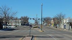
The Town of Limon is the Statutory Town that is the most populous municipality in Lincoln County, Colorado, United States. Limon is located immediately east of Elbert County. The population was 1880 at the 2010 United States Census. Limon has been called the "Hub City" of Eastern Colorado because Interstate 70, U.S. Highways 24, 40, and 287, and State Highways 71 and 86 all pass through the town. The Limon Correctional Facility is part of the Colorado Department of Corrections system and is a major employer in the area with employment of roughly 350. Limon is listed as the official AASHTO control city for signs on Interstate 70 between Denver and Hays, Kansas, although westbound signs in both Colorado and Kansas often omit Limon and list the larger city of Denver.
Contents
- Map of Limon CO 80828 USA
- Transportation
- Highways
- Railroads
- Airports
- Traveler Services
- Foreign Trade Zone
- Renewable Energy
- Conventional Energy
- Limon Schools
- Morgan Community College
- Limon Child Development Center
- Geography
- Climate
- Demographics
- Porter Lynching
- 1990 Tornado
- Radio
- Television
- References
Map of Limon, CO 80828, USA
Limon is the western terminus of the Kyle Railroad and it is here the shortline interchanges with the Union Pacific Railroad. Trains previously stopped at Limon Railroad Depot.
Transportation
Limon is called “Hub City" of Eastern Colorado because of its location on transportation systems. Five U.S. and state highways and two railroads converge at Limon making it the perfect stopping point for travelers and a great business location. It lies on a triangle with Denver and Colorado Springs making in an efficient stopping place and distribution site outside the congestion of Colorado’s Front Range.
Highways
Limon is connected by Interstate 70 east to Goodland (109 mi), Topeka (450 mi), Kansas City (500 mi),and west to Denver (eastern beltway-E-470 -75 mi; Interstate 25 - 87 mi), Silverthorne (155 mi), Winter Park (155 mi), Frisco/Breckenridge (160/170 mi), Vail (185 mi), Steamboat Springs (245 mi), Aspen (285 mi), and Grand Junction (335 mi). Interstate 70 is the major East-West Interstate between I-40 and I-80. The Ports-to-Plains Corridor including US 40/287 south and Colorado Highway 71 to the north of Limon connects to Amarillo (330 mi), Lubbock (455 mi) and Dallas (700 mi) to the south and Cheyenne, WY (210 mi) and Rapid City, SD and the Black Hills (390 mi) to the north without using congested highways. This corridor provides an uncongested alternative to Interstate 25 and Interstate 35 in moving freight and people north-south .
Colorado Highway 71, south from Limon connects to Rocky Ford (87 mi), La Junta (98 mi) and Pueblo (127 mi). US Highway 24 is the direct shot southwest from Limon to Colorado Springs (72 mi).
A major portion of the shipping between the Mid-West and the Western States rolls right through Limon.
Railroads
Limon is served by Class I Union Pacific Railroad and the Kyle Railroad owned by Genesee & Wyoming, Inc. The Kyle Railroad is a short-line railroad that runs from North Central Kansas into Eastern Colorado with Limon as the western terminus where it interchanges with the Union Pacific Railroad. With approximately 500 miles of track, Kyle offers interchanges with BNSF, NKCR and UP. The major commodities moving on the Kyle include wheat, soybeans, milo maize, alcohols, siding asphalt and roofing granules.
Railroads were the major factor for Limon’s original founding and location. The Kansas Pacific made its way across the plains from southern Kansas following the Smoky Hill Trail in 1870. In 1888 the Chicago, Rock Island, and Pacific Railroad (now the Kyle Railroad) made its way west to east from Colorado Springs, entering Lincoln County and intersected the Kansas Pacific (now Union Pacific) at the present day location of Limon. This union of the two railroads was the earliest founding of the “Hub City”.
Airports
The Town of Limon has easy, uncongested access to commercial airports in Denver and Colorado Springs. The distance between Limon and Denver International Airport (DEN) is 83 miles or about 75 minutes via Interstate 70. Colorado Springs Airport is located about 74 miles from Limon and about 80 minutes via U.S. Highway 24.
Limon Municipal Airport is a public use airport located within the Town of Limon on the eastern edge of town. The airport encompasses approximately 397 acres and is owned and operated by the Town of Limon. The airport is a general aviation airport utilized by a range of aircraft ranging from single-engine aircraft up to small sized multi-engine business jets. Limon Municipal Airport is located at 39°16’29.2”N latitude and 103°39”57.1”W longitude. The Airport elevation is 5,374 feet mean sea level (MSL). The current Runway Design Code for Runway 16/34 and ARC for the Limon Municipal Airport is B-I (Small). The current design aircraft for the airport is the Beech King Air 100. There is one runway at Limon Municipal Airport. Runway 16/34 is 4,700 feet long and 60 feet wide. The runway is constructed of Portland Concrete Cement with a published strength of 12,500 pounds single wheel gear. The taxiway system at the airport consists of partial parallel taxiway A with connector taxiway A1, A2, and A3. The taxiways are 25 feet wide and are in good condition. The aircraft apron provides an area for based and transient aircraft parking. Limon Municipal Airport has approximately 6,010 square yards of apron with 20 aircraft tie-downs. The airport provides fueling facilities by credit or proprietary cards.
Traveler Services
South of the Doug Kissel Fishing Pond just following the trail under the Kyle Railroad is the Limon Wetlands. This 14 acre site is located south of Limon and contains 8.2 acres of wetlands and 1.25 acres of open water.
Before pioneers settled in what is now Colorado, wetlands covered about 2% of the land. Because of increasing development and human activity, half of Colorado's original wetlands have been changed or lost since the mid-1800s.
With the importance of wetlands now understood, many agencies are working together to conserve and restore wetland areas. The Limon Wetlands were created when the Town of Limon and the Colorado Division of Wildlife initiated this project with the Colorado Department of Transportation. With funds from the Colorado Department of Transportation, construction began to transform a retired wastewater discharge lagoon into a wetland basin.
Over 10,000 cubic yards of fill dirt were used to shape the wetlands and a pumping system was installed to cycle approximately 150,000 gallons of treated sewage through the wetlands every day.
The successful completion of the LIMON WETLANDS in 1997 made it the 1st Wetlands Mitigation Bank in Colorado.
The Limon Wetlands consist of four different cells each with a unique wetland environment:
Approximately 4.2 acres are Palustrine Emergent Persistent with the dominant species including Cat Tail, Bulrush, Sedge and Three Square.
Another 1.6 acres are Palustrine Emergent Non-Persistent with the dominant species of Burreed, Arrowhead and Smartweed.
Additionally, 0.4 acres are Palustrine Broadleaf Deciduous with a dominant species of Willow.
Finally, 2.0 acres of Aquatic Rooted Vascular with the dominant species of Sago Pondweed.
The Limon Wetlands provide a habitat for wildlife. Migrating birds use the plentiful food sources of wetlands as "refueling stations" on their long flights every spring and fall. In the summer many birds build their nests amid the dense wetland plants.
Foreign Trade Zone
Limon and Lincoln County, with Town of Limon as Grantee, received a Grant of Authority for FTZ No. 293 on June 11, 2015. The Service Area includes all of the counties of Adams and Arapahoe and portions of the counties of Elbert, Lincoln and Morgan.
An FTZ is a designation, granted by U.S. Department of Commerce through the Foreign Trade Zone Board, designed to encourage U.S. job activity by allowing delayed or reduced duty payments on foreign components while using U.S. labor forces for production. From a local viewpoint an FTZ is a tool encouraging primary jobs in the U.S. that could have been offshored and creates tax revenues for counties, municipalities, school districts and special districts.
Duty payments on most imported components are due as soon as the component enters the United States. Those same components can be imported into a FTZ site and the duty is deferred until the final product enters the U.S. market. If the imported component is combined with domestic components into a final product, the duty paid is the lesser of the individual components or the final component. If the final product is then exported and never enters the U.S. market, no duty is paid to the U.S. So while local communities benefit and Colorado primary employees are used in processes, the company has a clear savings in customs duty.
Alternative Site Framework (ASF) is designed to serve zone projects that want the flexibility to both attract users/operators to certain fixed sites and to serve companies at other locations where the demand for FTZ services is expected to arise in the future. ASF improves the Grantee’s ability to bring competitive benefits of their FTZ to a broad range of companies, front-loads 90% of the leg work for designation of a site, reducing paperwork when a site needs to be designated as a FTZ and shortening the boundary modification process to roughly 30 days and allows the zone/site to become flexible for operation and administration.
Renewable Energy
Limon’s farming and ranching base has long provided both the economic base and the open space surrounding Limon. Farming and ranching continues to be a strong economic base but new industries are creating new opportunities and a different skyline. Limon's Renewable Energy Sector is currently ranking second in the state with a current installed production capacity of 852 MW, the wind capacity in Lincoln County is second to none. Four projects have been developed, permitted, constructed and producing. The Town of Limon is the core of the economic activity associated with these developments.
Renewable Energy Systems developed the Cedar Point Wind Farm with 139 - 1.8 MW Vestas turbines, two onsite project substations, one operations and maintenance building and more than 40 miles of overhead transmission line. The Cedar Point Project is owned by Enbridge under a power agreement with Xcel Energy. The Cedar Point Wind Farm generates 252 megawatts of electricity, enough clean renewable energy to meet the power needs of about 80,000 Colorado homes.
NextEra Energy Resources developed the Limon I and Limon II Wind Energy Center which came on line in late 2012. The 400 MW facility consists of twin 200-MW projects and 125 GE 1.6 MW wind turbines. Located on more than 55,000 acres, a 45-mile long 345 kV transmission line connects the wind farms to the substation.
NextEra's Limon Wind III Energy Center in Colorado came into service in 2014 with an additional 200 MW which will bring that total to 852 MW of installed production capacity. Limon Wind III Energy Center consists of 121 – GE 1.7 MW wind turbines located over 49,600 acres and an approximately ten miles of a 345kV transmission line running from the Limon Wind III substation to the Limon II substation.
In December, 2014, the Lincoln County Commissioners gave initial permit approval to NEREO for the Arriba Wind Farm. This project is proposed over two phases to have an installed production capacity of 300.1 MW utilizing 176 1.7 MW GE turbines. Located in eastern Lincoln County the project would cover 25,600 aces.
Xcel Energy Inc., on May 13, 2016, filed a plan with state regulators to build, own and operate its $1 billion Rush Creek Wind Project, which includes a 300 turbine, 600-megawatt wind farm and 90-mile transmission line in eastern Colorado.
The Rush Creek Wind Project, which will cover 90,000 acres, will be built in two sections. One section will be in Elbert County southwest of Limon. The other section will be southeast of Limon and cover parts of Lincoln, Kit Carson and Cheyenne counties.
As proposed, the Rush Creek wind farm would be Colorado’s biggest wind farm. The transmission line will be built through Arapahoe, Cheyenne, Elbert, Kit Carson and Lincoln counties, capable of handling 345 kilovolts of electricity. The line will move the power from eastern Colorado to Xcel’s service territory along the Front Range.
Conventional Energy
Oil and gas production, while in its early stages of development, has grown to a point where in October 2013, it ranks 4th in the state of Colorado in the number of drilling permits. Oil production in 2004 was 90,205 barrels and as a county Lincoln County was ranked 14th. In 2013 oil production had grown to 731,807 barrels, an increase of 811%. As a county, Lincoln County now ranks 5th in the state. Natural gas production in 2004 was 27,786 MCF. In 2013 natural gas production had grown to 355,500 MCF, an increase of 1279%.
In May 2014, the Business Research Division, Leeds School of Business, University of Colorado Boulder, published Oil and Gas Industry Economic and Fiscal Contributions in Colorado by County, 2008–2012. That report showed the Total Impact (direct, indirect, induced) in 2012 to be 39 jobs with $46.6 million in output and labor income of $1.2 million. The oil and gas industry in Lincoln County paid $1.18 million to Lincoln County, $1.1 million to schools and $34,636 to special districts in property taxes. Municipal governments in Lincoln County receive no property tax revenues from the oil and gas industry at this time. As of December, 2014, the Colorado Oil and Gas Conservation Commission had granted 174 drilling permits in Lincoln County in the past 12 months.
The Limon region produces the basics: food, electricity and fuel for distribution around the world.
Limon Schools
Limon Schools has a new K-12 facility that opened in the fall of 2015. The $22.5 million project built two stories of new classrooms that accommodate up to 600 students.
The building addition, designed design-build partner, Klipp, a division of GKK Works, adds 85,228 square feet and many site improvements to the campus. Among them are new classrooms, a library, a cafeteria and commons area and vibrant playgrounds.
Limon Elementary School is a public coed school with 240 students in grades K-5. According to state standards, 82% of students at this school are considered proficient in math and/or reading.
Limon Junior-Senior High School has 233 students in grades 6-12. According to state standards, 77% of students at this school are considered proficient in reading. Graduation rate is 90%.
Morgan Community College
Morgan Community College: Limon Center serves Arickaree, Flagler, Genoa-Hugo, Karval, Kit Carson, Limon, and Woodlin high schools. It currently offers A.A., A.S., A.A.S. & A.G.S. degrees; Transfer courses; Nursing pre-requisites; Agriculture & Business Management; GED preparation & testing; Specialty classes for teacher re-licensure; EMS training; and Computer classes.
Limon Child Development Center
Limon Child Development Center (Limon Head Start) offers a full-day, full-year preschool program for children ages 3–5. There are various funding programs available for children including Head Start, Colorado Preschool Program (CPP), CCCAP through the Lincoln County Department of Human Services, and private pay tuition.
Geography
Limon is located at 39°15′50″N 103°41′32″W at an elevation of 5,377 feet (1,639 m). It lies on the north side of Big Sandy Creek, a tributary of the Arkansas River, on the eastern edge of the Colorado Piedmont region of the Great Plains, and is near the eastern end of the Palmer Divide. Located in east-central Colorado at the junction of Interstate 70, U.S. Highway 40, U.S. Highway 24, and State Highway 71, Limon is far from any major city or town, being 72 miles (116 km) northeast of Colorado Springs, 83 miles (134 km) southeast of Denver, and 486 miles (782 km) west of Kansas City.
According to the United States Census Bureau, the town has a total area of 1.9 square miles (4.9 km2), all land.
Climate
Limon has a semi-arid steppe climate (Köppen BSk) with cold, dry winters and warm, mildly wetter summers. Due to its location on the eastern plains, the town is often subject to severe, sometimes violent thunderstorms throughout the summer. Large hail, damaging winds, heavy rain, and tornadoes are common in the summer months. The average temperature in Limon is 47.3 °F (8.5 °C), and the average relative humidity is 56%. Over the course of a year, temperatures range from an average low of 10 °F (−12 °C) in December to an average high of 87 °F (31 °C) in July. The high temperature reaches or exceeds 90 °F (32 °C) an average of 26 days a year and reaches or exceeds 100 °F (38 °C) an average of 0.6 days a year. The minimum temperature falls below the freezing point 32 °F (0 °C) an average of 188 days a year. Typically, the first fall freeze occurs by the fourth week of September, and the last spring freeze occurs by the third week of May. In a typical year, Limon receives 16 inches (410 mm) of precipitation, and there are 82 days of measurable precipitation. Annual snowfall averages 43 inches (110 cm). Measurable snowfall occurs an average of 31 days a year with at least an inch of snow being received on 12 of those days. Snow depth of at least an inch occurs an average of 50 days a year. On average, December is the coldest month, July is the hottest month, and August is the wettest month. The hottest temperature recorded in Limon was 100 °F (38 °C) in 1990; the coldest temperature recorded was -27 °F (-33 °C) in 1984.
Demographics
As of the 2010 census, there were 1,880 people, 828 households, and 476 families residing in the town. The population density was 989.5 people per square mile (382/km²). There were 963 housing units at an average density of 506.8 per square mile (200.6/km²). The racial makeup of the town was 93.2% White, 0.9% American Indian, 0.8% African American, 0.8% Asian, 0.1% Pacific Islander, 2.8% from some other race, and 1.5% from two or more races. 9.4% of the population was Hispanic or Latino of any race.
There were 828 households out of which 32.9% had children under the age of 18 living with them, 41.9% were married couples living together, 4.7% had a male householder with no wife present, 10.9% had a female householder with no husband present, and 42.5% were non-families. 37.1% of all households were made up of individuals, and 18.0% had someone living alone who was 65 years of age or older. The average household size was 2.27, and the average family size was 3.00.
In the town, the population was spread out with 27.4% under the age of 18, 8.4% from 18 to 24, 23.0% from 25 to 44, 25.0% from 45 to 64, and 16.2% who were 65 years of age or older. The median age was 37.6 years. For every 100 females, there were 90.7 males. For every 100 females age 18 and over, there were 85.6 males age 18 and over.
As of 2009, the median income for a household in the town was $40,903, and the median income for a family was $46,061. Males had a median income of $49,097 versus $31,615 for females. The per capita income for the town was $22,442. About 16.6% of families and 18.2% of the population were below the poverty line, including 25.5% of those under age 18 and 4.8% of those age 65 or over.
Porter Lynching
Limon was the site of a lynching on November 16, 1900. Preston Porter Jr, a sixteen-year-old African-American male, had confessed to the murder of eleven-year-old Louise Frost who was Caucasian. Porter was apparently being held some 90 miles away in Denver, but was sent back to Limon by request of unspecified people and against the wishes of Sheriff Freeman. When the train carrying Porter stopped in Limon, sixteen men selected from a mob of 300 "marked by calmness and determination" took Porter from Freeman's custody despite the sheriff's protestations "in the name of law." Originally it was announced that Porter would be hanged but many in the crowd including R. W. Frost, the girl's father, objected "that such a death would be too easy." The method was left to Frost who decided upon burning at the stake. Frost also refused to allow mutilation of Porter's body before burning. While waiting for his execution, Porter sat next to a bonfire reading the Gospel of Luke from the Bible. Porter was chained to a iron railroad rail set in the ground on the exact spot where the murder had taken place and burned to death, the match to start the fire being set by the girl's father. Lynchings of this type were apparently rare, as reporters on the scene wrote: "The general sentiment expressed approves the execution of the negro, but deprecates the method adopted."
1990 Tornado
On June 6, 1990, a tornado rated an F3 touched down near Matheson (about 16 miles west of Limon), tearing roughly east-northeast through fields. Minutes later, the then rain-wrapped tornado arrived, devastating the city. The storm killed two people and injured 14 others. Most of Limon's business district had been laid to ruins in just moments.
Governor Roy Romer declared Limon a disaster area the next day.
Limon successfully rebuilt its business district adding streetscaping, a new Town Hall, relocating a medical clinic and Limon Memorial Library, creating Hub City Senior Center and a new fire station. Downtown Limon is now a thriving center of the community demonstrating the strength of this rural community.
The Limon Leader is the city's weekly newspaper, published by Hoffman Publications, LLC and has a circulation of about 3,200 copies.
Radio
The following radio stations are licensed to and/or broadcast from Limon:
AM
FM
Television
Limon is in the Denver television market.