
Country United States FIPS code 53-53930 Elevation 128 m Zip code 98572 Local time Saturday 1:49 AM | Time zone Pacific (PST) (UTC−8) GNIS feature ID 1507338 Area 153 ha Population 624 (2013) Area code 360 | |
 | ||
Weather 6°C, Wind S at 13 km/h, 89% Humidity | ||
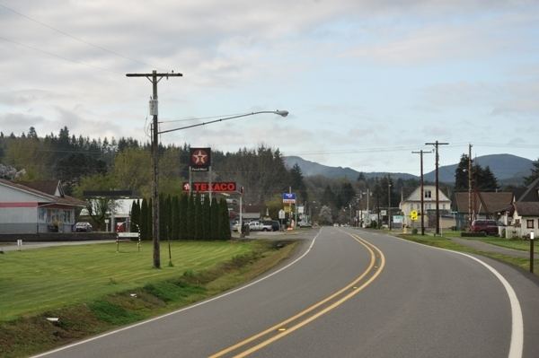
Walk around pe ell washington weird grave yard old war tank
Pe Ell (/piːɛl/) is a town in Lewis County, Washington, United States. The population was 632 at the 2010 census.
Contents
- Walk around pe ell washington weird grave yard old war tank
- Map of Pe Ell WA USA
- How to say or pronounce usa cities pe ell washington
- History
- Geography
- 2010 census
- 2000 census
- Politics
- References
Map of Pe Ell, WA, USA
How to say or pronounce usa cities pe ell washington
History
Pe Ell was officially incorporated on March 9, 1906.
There have long been several versions of how Pe Ell was named, none of which can be authenticated.
In 1897, the North Pacific Railway built a railroad depot in the town. In 1907 Pe Ell's population was around 1,000—larger than it is today. The rich agricultural and timber resources of the region attracted farmers, millworkers, and loggers. By 1909, the town had a bank, three dry goods stores, two general stores, three grocery stores, two barber shops, five saloons, four hotels, a newspaper, a blacksmith, and even an opera house.
Geography
Pe Ell is located at 46°34′17″N 123°17′49″W (46.571415, -123.296842).
According to the United States Census Bureau, the town has a total area of 0.59 square miles (1.53 km2), all of it land.
2010 census
As of the census of 2010, there were 632 people, 259 households, and 169 families residing in the town. The population density was 1,071.2 inhabitants per square mile (413.6/km2). There were 290 housing units at an average density of 491.5 per square mile (189.8/km2). The racial makeup of the town was 91.3% White, 0.2% African American, 3.2% Native American, 1.7% from other races, and 3.6% from two or more races. Hispanic or Latino of any race were 4.3% of the population.
There were 259 households of which 32.8% had children under the age of 18 living with them, 49.0% were married couples living together, 10.4% had a female householder with no husband present, 5.8% had a male householder with no wife present, and 34.7% were non-families. 26.6% of all households were made up of individuals and 12.8% had someone living alone who was 65 years of age or older. The average household size was 2.44 and the average family size was 2.91.
The median age in the town was 40 years. 25% of residents were under the age of 18; 7.2% were between the ages of 18 and 24; 23.4% were from 25 to 44; 26.6% were from 45 to 64; and 17.7% were 65 years of age or older. The gender makeup of the town was 49.7% male and 50.3% female.
2000 census
As of the census of 2000, there were 657 people, 248 households, and 174 families residing in the town. The population density was 1,099.7 people per square mile (422.8/km²). There were 289 housing units at an average density of 483.7 per square mile (186.0/km²). The racial makeup of the town was 93.15% White, 0.30% African American, 2.28% Native American, 0.91% Asian, 0.61% Pacific Islander, 1.07% from other races, and 1.67% from two or more races. Hispanic or Latino of any race were 2.28% of the population. 23.5% were of American, 15.1% English, 12.8% German, 9.9% Irish and 8.5% Polish ancestry.
There were 248 households out of which 33.9% had children under the age of 18 living with them, 54.8% were married couples living together, 8.9% had a female householder with no husband present, and 29.8% were non-families. 23.8% of all households were made up of individuals and 12.1% had someone living alone who was 65 years of age or older. The average household size was 2.65 and the average family size was 3.17.
In the town, the age distribution of the population shows 30.6% under the age of 18, 7.3% from 18 to 24, 25.9% from 25 to 44, 22.2% from 45 to 64, and 14.0% who were 65 years of age or older. The median age was 34 years. For every 100 females there were 107.3 males. For every 100 females age 18 and over, there were 103.6 males.
The median income for a household in the town was $27,321, and the median income for a family was $30,625. Males had a median income of $36,875 versus $18,125 for females. The per capita income for the town was $12,481. About 20.0% of families and 22.4% of the population were below the poverty line, including 32.7% of those under age 18 and 10.8% of those age 65 or over.
Politics
Pe Ell is a predominantly Republican area, although less so than Lewis County as a whole. The results for the 2004 U.S. Presidential Election were as follows: