
Area 14,307 km² | Time zone EST (UTC−5) Population 443,000 (2016) | |
 | ||
Demonym(s) Bahamian, Turks Islander, Caicos Islander Islands Paradise Island, Parrot Cay, Inagua Islands, Castaway Cay, Little San Salvador Island Points of interest Atlantis Paradise Island, Dolphin Cay Atlantis, Marine Habitat at Atlantis, Atlantis Casino, The Dig | ||
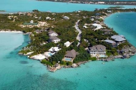
The Lucayan Archipelago, also known as the Bahama Archipelago, is an island group comprising the Commonwealth of the Bahamas and the British Overseas Territory of the Turks and Caicos Islands. The archipelago is in the western North Atlantic Ocean, north of the Antilles, and east and southeast of Florida.
Contents
- Map of Lucayan Archipelago The Bahamas
- Proposed federation
- Countries and territories
- Geological formation
- References
Map of Lucayan Archipelago, The Bahamas
William Keegan writes that the Bahama archipelago includes the territories of both the Commonwealth of the Bahamas and the Turks and Caicos Islands, adding: "Modern political considerations aside, the islands form a single archipelago with common geological, ecological, and cultural roots." Because the two nations of the Lucayan Archipelago do not border the Caribbean Sea, they are technically part of the West Indies but not the Caribbean. They are, however, often grouped with the Caribbean nations for convenience.
Proposed federation
The leaders of the Bahamas as well as Turks and Caicos Islands discussed the possibility of forming a federation in 2010.
Countries and territories
Geological formation
The Lucayan Archipelago was originally formed by the rifting of Pangea, the Super-continent, which resulted in the opening of North Atlantic basin. The rifting of Pangea was accompanied by volcanic activity due to the nature of the colliding North American and Caribbean plates. The collisions, commonly subduction zones where one plate is pulled under the other, formed the lower layer, which is commonly referred to as the basement rocks upon which the Bahamian islands now reside. Evidence of the volcanic activity is found in the tilted fault blocks of Jurassic volcaniclastics which are commonly found in the Florida Straits area (Vacher 95). In the southern region of the Bahamas, the basement rocks are oceanic crust, showing that the area was not a transitional region during the opening of the North Atlantic basin.
The Bahamas are referred to as carbonate islands, which is due to the formation of carbonate banks. This megabank formed in the Late Jurassic and is evidence of an absence of deep water at the time of formation due to the type of rock formed. Carbonates are more likely to form in shallower waters, thus the formation of two major carbonate banks in the Bahamas shows that there was an absence of deep water (Marshak). There is also evidence of faulting which is shown in the tilting of the Bahama Banks. This tilting is due to the subduction of the North American plate under the Caribbean plate, in the vicinity of Cuba. The angle of tilting, which is left-lateral wrench faulting is in the direction of the subduction, supporting Cuban vicinity as the location of subduction (Vacher 96). This faulting occurred because as the North American plate subducted under the Caribbean plate, not all the rock layers moved as one continuous unit. The Bahaman islands remained in the same location, thus the rocks had to fault, or break, in order for the North American plate to continue subduction and the islands to remain in their current location.