
Population 11,645 (2015 est) | Mayor Paul Maytom Area 1,167 km² | |
 | ||
Points of interest Fivebough & Tuckerbil Wetlands, Toorak Winery, Lillypilly Estate Wines | ||
60 second tour of leeton shire
Leeton Shire is a local government area in the Riverina region of New South Wales, Australia. The Shire is located adjacent to the Murrumbidgee River and falls within the Murrumbidgee Irrigation Area.
Contents
- 60 second tour of leeton shire
- Map of Leeton NSW Australia
- Leeton 26 12 2016 race 7 leeton shire council three year old pace
- Current composition and election method
- References
Map of Leeton, NSW, Australia
The Shire includes the town of Leeton and the small towns of Yanco, Gogeldrie, Whitton, Wamoon, Stoney Point, Murrami, Corbie Hill, Amesbury, Merungle Hill, Fivebough and Stanbridge and the suburbs of Parkview, Wattle Hill, Wiradjuri, North Leeton, Gralee and Willimbong.
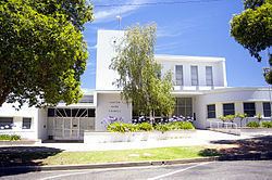
The mayor of Leeton Shire is Paul Maytom.
Leeton 26 12 2016 race 7 leeton shire council three year old pace
Current composition and election method
Leeton Shire Council is composed of nine councillors elected proportionally as a single ward. All Councillors are elected for a fixed four-year term of office. The mayor is elected by the councillors at the first meeting of the Council. The most recent election was held on 10 September 2016, and the makeup of the Council is as follows::
The current Council, elected in 2016, in order of election, is: