
Peak Keeromsberg Width 20 km (12 mi) NE/SW Easiest route From Montagu | Length 250 km (160 mi) NW/SE Elevation 2,075 m Period Paleoproterozoic | |
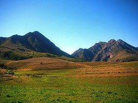 | ||
Langeberg mp4
The Langeberg Range is a mountain range in the Western Cape province of South Africa. Its highest peak is Keeromsberg at 2075m and 15 km NE of the town of Worcester. Some of the highest peaks of the range are located just to the north of Swellendam, in a subrange known as the Clock Peaks whose highest point is 1710 m high Misty Point. Local lore states one can tell the time by means of the shadows cast by the seven summits of the Clock Peaks.
Contents
- Langeberg mp4
- Map of Langeberg South Africa
- Physiography and geology
- Ecology
- Protected areas
- Mountain passes
- References
Map of Langeberg, South Africa
The name is Dutch and means "long mountain"
Physiography and geology
The range runs roughly NW/SE in its western part and in an east-west direction in its mid and eastern section and is approximately 250 km long, from Worcester, past Robertson, Montagu, Swellendam, Heidelberg and Riversdale to the proximity of George. The Langeberg's most westerly point is located 5 km east of the town of Worcester; the range ends some 20 km North of Mossel Bay in the east. The open plains of the Little Karoo border the north of the mountain range, while to the south lies the Agulhas Plain and the Overberg wheatbelt.
The Langeberg Range is composed mostly of Table Mountain Sandstone and the range is part of the Cape Fold Belt.
Ecology
On the southern slopes of the range mountain fynbos can be found, with Afromontane forest patches found in deep secluded gorges, while on the drier northern slopes karroid scrub is found.
Protected areas
There are the following protected areas along the range:
Mountain passes
The range is traversed by four mountain passes, from west to east, they are: