
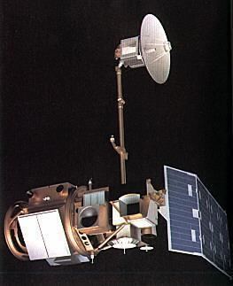
Mission type Earth imaging COSPAR ID 1982-072A Manufacturer Fairchild Industries Inclination 98.2° Period 1.6 hours Rocket Delta 3000 | SATCAT no. 13367 Launch date 16 July 1982 Inclination 98.2° Launch mass 1,941 kg | |
 | ||
Bus Multimission Modular Spacecraft Similar | ||
Calculating effective at satellite temperature landsat 4 5 7
Landsat 4 is the fourth satellite of the Landsat program. It was launched on July 16, 1982, with the primary goal of providing a global archive of satellite imagery. Although the Landsat Program is managed by NASA, data from Landsat 4 was collected and distributed by the U.S. Geological Survey. Landsat 4 science operations ended on December 14, 1993 when the satellite lost its ability to transmit science data, far beyond its designed life expectancy of five years. The satellite housekeeping telemetry and tracking continued to be maintained by NASA until it was decommissioned on June 15, 2001.
Contents
Specifications
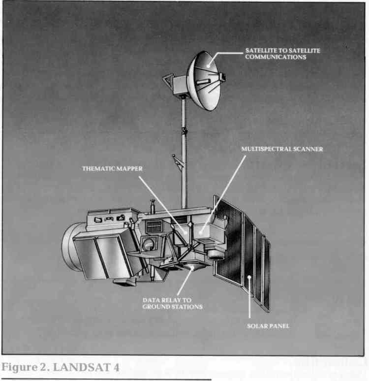
Landsat 4 carried an updated Multi-Spectral Scanner used on previous Landsats, and a Thematic Mapper. It had a maximum 30 m resolution. Shortly after launch, the satellite lost half of its solar power and the ability to send science data directly to Earth, prompting fears the satellite would fail sooner than expected. This prompted the early launch of Landsat 5, a satellite identical in specification to Landsat 4. Landsat 4 was able to resume science operations when the Tracking and Data Relay Satellite System came on line, then was placed in standby in January 1986. Landsat 4 was brought back on line to provide international coverage in 1987, when Landsat 5 lost its TDRS link, and thus the ability to image areas beyond line of sight to a ground station, and continued to do so until it, too, lost its TDRS link in 1993, ending science data return. The data rate for TM data was 84.9Mb/s, via by X-band transmitter to modernized ground antennas. Landsat 4 could transmit data via S-band for TT&C and Ku-band to transmit to TDRS.
Landsat 4 was the first satellite in the Landsat program to incorporate the TM (Thematic Mapper) sensor. The Landsat TM sensor is able to gather seven bands of data as opposed to the four bands of data collected from the MSS (Multispectral Scanner.) In addition to having three more bands of data to work with, scientists are able to view the TM data at a much higher resolution than with MSS. Bands 1–5 and 7 each have a spatial resolution of 30m while the MSS is only offered in a 57m by 79m resolution. Band 6 (which is a Thermal infrared band) has a maximum spatial resolution of 120m.
Landsat 5 was an identical clone of L4, it was a backup satellite, but it went on to outlive Landsat 4, and was operated for nearly 30 years of active operation in space. In the end it was intentionally terminated by using its remaining fuel to lower its orbit and its transmitter turned off. It was survived by the still-functioning Landsat 7 and recently launched Landsat 8.