
Area 2,979 km² | Time zone EST (UTC-5) | |
 | ||
Municipalities Towns & townshipsBeckwith (township)Carleton Place (town)Drummond/North Elmsley (township)Lanark Highlands (township)Mississippi Mills (town)Montague (township)Perth (town)Tay Valley (township) Clubs and Teams Smiths Falls Bears, Carleton Place Canadians, Almonte Jr. Sharpshooters, Almonte Thunder, Perth Blue Wings Points of interest Matheson House, Mount Pakenham, Silver Lake Provincial Park, Trans Canada Trail, Murphys Point Provincial Destinations Smiths Falls, Perth, Carleton Place, Mississippi Mills, Trans Canada Trail | ||
Lanark County is a county located in the Canadian province of Ontario. Its county seat is Perth, which was first settled in 1816. Most European settlement of the county began in 1816, when Drummond, Beckwith and Bathurst townships were named and initially surveyed. The first farm north of the Rideau was cleared and settled somewhat earlier, in 1790. The county took its name from the town of Lanark in Scotland. Nearly all the townships were named after British public and military figures from the era of early settlement.
Contents
- Map of Lanark County ON Canada
- Come to know lanark county in ontario s highlands
- Geography
- Subdivisions
- Original townships
- Demographics
- Economy
- References
Map of Lanark County, ON, Canada
Come to know lanark county in ontario s highlands
Geography
The county is located in the subregion of Southern Ontario named Eastern Ontario. Geologically, the northern part of the county is in the Canadian Shield and the southern part is in the Great Lakes Basin. The county has two large rivers, the Mississippi and Rideau, each of which empty into the Ottawa River. The landscape is varied including Canadian Shield (with gneiss, granite and marble) as well as limestone plains, with a variety of tills, sands and clays left from the melting of glaciers in the last ice age.
At the time of settlement, most of the county was covered in temperate deciduous forest; the dominant forest trees included maple, hemlock, oak and beech. Some of the higher ridges in the west of the county were likely once natural fire barrens, with a distinctive fauna and flora. The clearance of forests began with early settlement, at which time one of the important exports from the area was potash, made from the ashes of the trees burned in clearing.
The natural diversity of the landscape supports over 1200 species of plants in the county flora. Seventeen areas have been documented as outstanding examples of plant diversity; these include Blueberry Mountain, Burnt Lands Alvar, Clay Bank Alvar, Christie Lake, Murphy's Point Provincial Park and Almonte Town Park. The county also has 47 provincially significant wetlands. Some of the largest are Blueberry Marsh (north of Perth), the Innisville Wetlands (upstream of Mississippi Lake) and the Goodwood Marsh south of Carleton Place. In addition to David White's list of 17 areas of plant diversity, Paul Keddy lists 17 special places in the county. Both lists have the Burnt Lands Alvar, the Christie Lake Barrens and Murphy's Point Provincial Park. Keddy's list adds areas such as Playfairville Rapids, Lavant/Darling Spillway and the Carleton Place Hackberry stand. Also of interest is an old shoreline which crosses the county diagonally, approximately from Almonte in the northeast to Perth in the southwest. This shoreline was formed about 12,000 years ago near the end of the last ice age when much of the Ottawa Valley was inundated by the Champlain Sea. Many areas below this old shoreline are flat clay plains, with occasional outcrops of gneiss or limestone ridges.
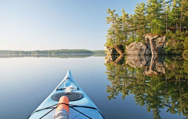
Some of the distinctive southern animals in the county include five-lined skinks (Ontario's only species of lizard), black rat snakes and southern flying squirrels. Unusual southern plants include the Arrow arum, a nationally rare wetland plant found near Mississippi Lake. The south-facing cliffs over Big Rideau Lake, including Foley Mountain, have a slightly warmer climate, and therefore support an unusual southern flora including shagbark hickory, tall cinquefoil (Potentilla arguta) and a rare fern, blunt-lobed woodsia. Cliff Bennett provides a list of 26 routes for canoe and kayak exploration of the county.
Subdivisions
While the town of Smiths Falls is physically within the boundaries of the county, it is a separated municipality and is not under the administration of the county government.
Original townships
Demographics
The figures below are for the Lanark census division, which combines Lanark County and Smiths Falls.
Historic populations:
As of the census of 2001, there were 62,495 people, 23,905 households, and 18,090 families residing in the county. The population density was 21 per square kilometre (54/sq mi). There are 27,781 housing units.
There were 23,905 households out of which 32.54% had children living with them, 32.54% were married couples living together, 23.32% are one-person households, and 12.31% are other household types.
In the county, the population was spread out with 19.68% of the population under the age of 15, 11.78% from 15 to 24, 27.39% from 25 to 44, 25.85% from 45 to 64, and 15.28% who were 65 years of age or older. The median age was 40.
The median income for a household in the county was $49,701, and the median income for a family was $56,873. Males have an average income of $45,494 versus $33,525 for females.
Economy
The county is one of the top centres of maple syrup production in Ontario and describes itself as "The Maple Syrup Capital of Ontario". .