Samiksha Jaiswal (Editor)

Lambayeque Province

Updated on
Edit
Like
Comment
Share on FacebookTweet on TwitterShare on LinkedInShare on Reddit
Country
  
Peru

UBIGEO
  
1403

Region
  
Lambayeque Region

Elevation
  
17 m (56 ft)

Area
  
9,347 km²

Capital
  
Lambayeque

Lambayeque Province httpsuploadwikimediaorgwikipediacommonsthu

Website
  
www.munilambayeque.gob.pe

The Lambayeque Province is the largest of three provinces in Peru's Lambayeque Region.

Contents

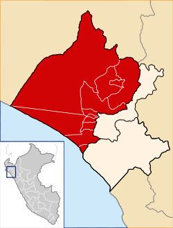
Map of Lambayeque Province, Peru

Boundaries

  • North, Northwest and West: Piura Region
  • Southeast Ferreñafe Province and Chiclayo Province
  • Southwest Pacific Ocean
  • Political Division

    The province has an area of 9,346.63 square kilometers (3,608.75 sq mi) and is divided into twelve districts.

  • Lambayeque
  • Chochope
  • Illimo
  • Jayanca
  • Mochumi
  • Morrope
  • Motupe
  • Olmos
  • Pacora
  • Salas
  • San José
  • Túcume
  • Population

    The province has an approximate population of 230,385 inhabitants.

    Capital

    The provincial capital is Lambayeque.

    References

    Lambayeque Province Wikipedia