
Time zone PET (UTC-5) Elevation 175 m | Capital Olmos UBIGEO 140308 Area 5,335 km² | |
 | ||
Olmos District is one of twelve districts of the province Lambayeque in Peru.
Contents
Map of Olmos, Peru
History
The name of the district comes from the town of Olmos, meaning "elms", because the pale bark of the trees in the surrounding forest reminded the Spanish settlers of the elm trees back in Spain. At the time of the arrival of the Spaniards the area was occupied by the Quechuas and the extensive region of Olmos was administered by the Kingdom (curacazgo) of Copiz, which was under the Inca Empire. The pre-existing town was recognized in 1544 by the viceroy Blasco Núñez Vela.
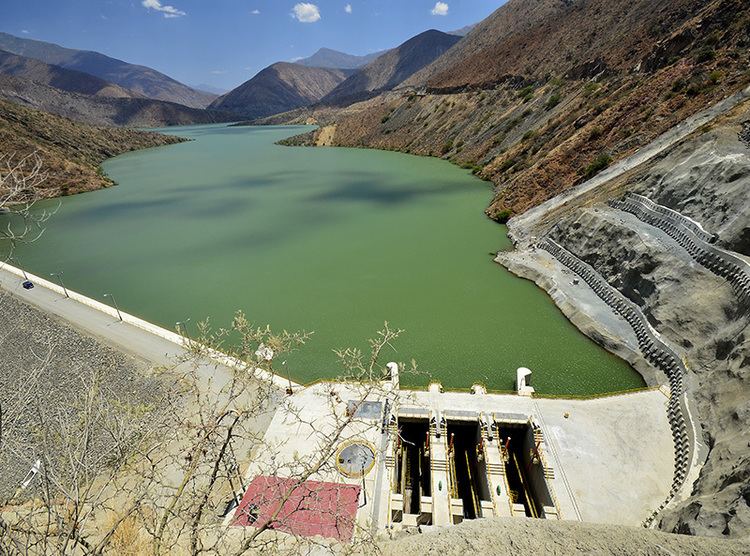
Hydrographics
The major river in the district is the Olmos River. Other important rivers are the Cascajal River, the Insculás River, the Ñaupe River, and the San Cristóbal River. The Limón Dam is part of the Olmos irrigation project which is intended to irrigate dry region west of the Andes by damming the flood-prone Huancabamba River.