
Country India Telephone/STD code 03482 Area 134 km² Area code 03482 | Time zone IST (UTC+5:30) Elevation 26 m Population 335,831 (2011) | |
 | ||
PIN 742148 (Lalgola)742185 (Krishnapur) | ||
Lalgola is a community development block that forms an administrative division in Lalbag subdivision of Murshidabad district in the Indian state of West Bengal. Lalgola police station serves this block. Headquarters of this block is at Lalgola. It is located 42 km from Baharampur, the district headquarters.
Contents
Location
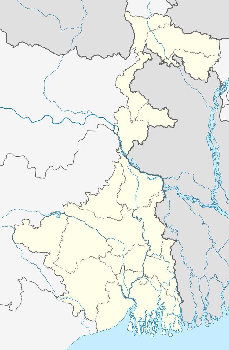
Lalgola is located at 24°25′N 88°15′E
Lalgola CD Block is bounded by Rajshahi District of Bangladesh, across the Padma, in the north, Bhagawangola II CD Block in the east, Bhagawangola I CD Block in the south and Raghunathganj I and Raghunathganj II CD Blocks in the west.
Area
Lalgola community development block has an area of 134.00 km2.
Physical features
The Bhagirathi divides the district into two parts namely Bagri on the east and Rahr on the west. The Padma separates the district from Malda district, and Chapai Nawabganj and Rajshahi districts of Bangladesh.
Gram panchayats
Gram panchayats in Lalgola block/ panchayat samiti are: Airmari Krishnapur, Bahadurpur, Bilborakopra, Dewansarai, Jasaitala, Kalmegha, Lalgola, Maiya, Manikchak, Nashipur, Paikpara and Ramchandrapur.
Population
As per 2011 Census of India Lalgola CD Block had a total population of 335,831, all of which were rural. There were 170,997 (51%) males and 164,834 (49%) females. Population below 6 years numbered 54,961. Scheduled Castes numbered 31,248 and Scheduled Tribes numbered 168.
As per 2001 census, Lalgola block has a total population of 267,593, out of which 136,853 were males and 130,710 were females. Lalgola block registered a population growth of 29.40 per cent during the 1991-2001 decade. Decadal growth for the district was 23.70 per cent.Decadal growth in West Bengal was 17.84 per cent.
Large villages
Large villages under Lalgola CD Block were (2011 population figures in brackets): Maia (15,131), Bayra (15,259), Paharpur (13,368), Amarkunda (5,605), Makimnagar (4,057), Ilimpur (6,204), Nasipur (8,696), Syampur (4,443), Rajarampur (10,528), Paikpara (12,138), Nadaipur (9,401), Basui (4,676), Upar Fatepur (7,142), Krishnapur (19,462), Ramchandrapur (4,358), Karttickpur (5,687), Kalmegha (8,176), Bansgara (8,671), Lalgola (31,698), Hazi Mahammadpur (4,227), Paschim Durbarpara (5,056), Krishnapur Dinurpara (7,502), Brahimottar Manick Chak (7,800), Bajupur Madhupur (9,771), Diar Fatepur (10,536) and Sites Nagar (7,123).
Literacy
As per 2011 census the total number of literates in Lalgola CD Block was 180,646 (64.32% of the population above 6 years) out of which 94,242 (52%) were males and 86,404 (48%) were females.
As per 2011 census, literacy in Murshidabad district was 66.59. Literacy in West Bengal was 77.08% in 2011. Literacy in India in 2011 was 74.04%.
Language
Bengali is the local language in these areas.
Healthcare
Lalgola block is one of the areas where ground water is affected by arsenic contamination.
Transportation
The Ranaghat-Lalgola branch line was opened in 1905.