
Surface area 909 acres (368 ha) Area 3.679 km² Length 16,093 m | Max. length 10 miles (16 km) Average depth 29 feet (8.8 m) Max depth 22 m First flooded 1919 | |
 | ||
Managing agency Lake Zoar Authority, 'FirstLight Power Resources | ||
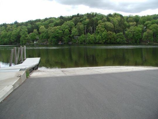
Monroe ct lake zoar
Lake Zoar is a reservoir on the Housatonic River in the U.S. state of Connecticut. It is formed by Stevenson Dam. The towns of Monroe, Newtown, Oxford, and Southbury border Lake Zoar.
Contents
- Monroe ct lake zoar
- Map of Lake Zoar Connecticut USA
- Lake zoar drive in restaurant ct
- Lake Zoar Authority
- Notable events
- Boating
- Access
- Fishing
- Fish species
- PCBs and fish consumption
- Invasive plant species
- Hiking
- References
Map of Lake Zoar, Connecticut, USA
The lake was created by flooding an area named "Pleasantvale" or "Pleasant Vale", which had been part of Oxford and Stevenson.
Lake zoar drive in restaurant ct
Lake Zoar Authority
The Lake Zoar Authority (LZA) is an organization for promoting safety on the lake and improving water quality. The members represent the four towns bordering the lake and meet on a monthly basis. Authority is granted through the Connecticut General Statutes, section 7-151a (of the 1969 supplement).
Notable events
Boating
There is a speed limit of 45 mph (72 km/h) limit daytime, 25 mph (40 km/h) from 30 minutes after sunset to 30 minutes before sunrise. Vessels are prohibited from approaching within 300 feet (91 m) on upstream side or 700 feet (210 m) on downstream side of Stevenson Dam. Activities including fishing, water-skiing and jet skiing are permitted.
Access
Each of the towns has a public access boat launch. The Southbury location is maintained by the state of Connecticut and is open to non-town residents. Additionally, there is canoe access from Kettletown State Park.
Fishing
Lake Zoar is stocked yearly with fish by the Connecticut Department of Environmental Protection.
Fish species
The lake contains the desirable Smallmouth Bass, Largemouth Bass, White Perch, Yellow Perch, Calico Bass (Black Crappie), White Catfish (Ictalurus catus), Brown Bullhead, Rainbow Trout, and the Common Carp.
PCBs and fish consumption
Most fish from Lake Zoar are generally considered safe to eat in moderation, with the exception of the Northern Pike. In a 2008 study by the United States Department of Health and Human Services Smallmouth Bass varied between 0.35 and 0.58 ppm, suitable for one meal per month. PCB levels in the lake have fallen considerably since the 1980s.
Invasive plant species
Four invasive species exist in the lake as of a 2007 study, including Eurasian watermilfoil, Brittle waternymph, Curly leaf pondweed, and European waterclover.
Hiking
The Zoar Trail is a 6.5-mile (10.5 km) Blue-Blazed Trail in Newtown maintained by the Connecticut Forest and Park Association.