
Built 1917 Opened 1917 Architectural style Neoclassical architecture | NRHP Reference # 00001073 Area 3 ha Added to NRHP 29 September 2000 | |
 | ||
Similar Stevenson Dam Bridge, Shepaug Dam, Lillinonah Trail, Kettletown State Park, Indian Well State Park | ||
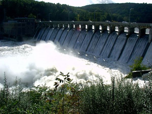
The Stevenson Dam Hydroelectric Plant is a hydroelectric power plant located on the Housatonic River at the boundary between the towns of Monroe and Oxford, Connecticut. The plant was built in 1917 and was listed on the National Register of Historic Places in 2000. The site includes three contributing structures: the Stevenson Dam, the Stevenson Dam Bridge, and the Stevenson Powerhouse. The impounding of the Housatonic River by the Stevenson Dam created Lake Zoar, a lake with 27 miles of shoreline. The plant was covered in a Historic American Engineering Record (HAER) study, record CT-183.
Map of Stevenson Dam, Monroe, CT 06468, USA
The Stevenson Dam Bridge, a reinforced concrete bridge that is integrated with the dam, carries Route 34 across the river. The Stevenson Powerhouse is a 160 by 80 ft building rising 131 ft in height. Its exterior includes "massive" pilasters.