
Primary inflows Max. length 74 km (46 mi) Length 74 km Mean depth 26 m | Area 1,242 km² Volume 32.8 km³ | |
 | ||
Managing agency Ministry of Nature Protection Similar Sevanavank, Geghard, Khor Virap, Noravank, Tatev monastery | ||
Lake sevan gegharkunik province armenia eurasia
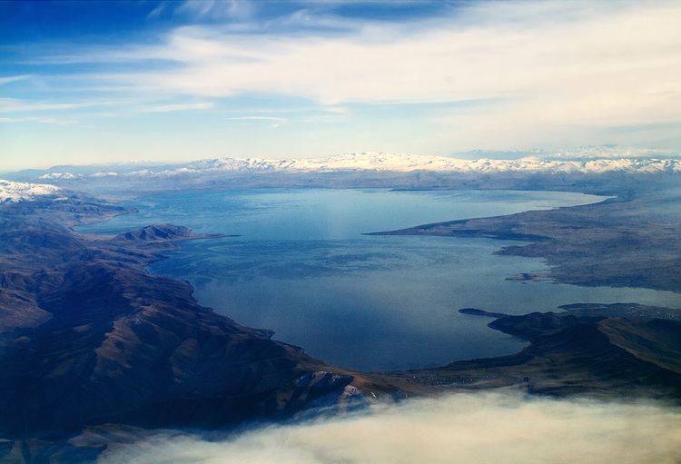
Lake Sevan (Armenian: Սևանա լիճ, Sevana lič̣) is the largest body of water in Armenia and the Caucasus region, and one of the largest freshwater high-altitude lakes in Eurasia. The lake is situated in Gegharkunik Province, at an altitude of 1,900 m (6,234 ft) above sea level. The total surface area of its basin is about 5,000 km2 (1,900 sq mi), which makes up 1⁄6 of Armenia's territory. The lake itself is 1,242 km2 (480 sq mi), and the volume is 32.8 km3 (7.9 cu mi). It is fed by 28 rivers and streams. Only 10% of the incoming water is drained by the Hrazdan River, while the remaining 90% evaporates.
Contents
- Lake sevan gegharkunik province armenia eurasia
- Map of Sevan Lake Armenia
- Sevan
- Other names
- Cultural
- Economic
- Origin
- Background
- Implementation
- Effects
- Reversal and recovery
- ArpaSevan tunnel
- VorotanArpa tunnel
- Increase in water level
- Population
- Beaches
- Sites of interest
- Fish
- Other species
- References
Map of Sevan Lake, Armenia
Sevan provides some 90% of the fish and 80% of the crayfish catch of Armenia. It has significant economic, cultural, and recreational value. Its only island (now a peninsula) is home to a medieval monastery.
Sevan was heavily exploited for irrigation of the Ararat plain and hydroelectric power generation during the Soviet period. Consequently, its water level decreased by around 20 m (66 ft) and its volume reduced by more than 40%. Two underground tunnels were later built to divert water from highland rivers, which halted its decline and its level began rising. Before human intervention dramatically changed the lake's ecosystem, the lake was 95 m (312 ft) deep, covered an area of 1,416 km2 (547 sq mi) (5% of Armenia's entire area), and had a volume of 58.5 km3 (14.0 cu mi). The lake's surface was at an altitude of 1,916 m (6,286 ft) above sea level.
Lake sevan gegharkunik province armenia eurasia
Sevan
"Sevan" is thought by scholars to have originated from the Urartian word suinia or suinna or sunia, which means "lake". The term is found on an 8th-century BC inscription by the Urartian king Rusa I, found in Odzaberd, in the southern shore on the lake.
There are at least two popular versions of origins of the word "Sevan". According to one, Sevan comes from the Armenian words sev (black) and vank’ (monastery), referring to the island monastery. The second version links Sevan's name with that of Lake Van. It is said that long ago, Armenians came from the areas around Lake Van to Lake Sevan. They saw that the lake was dark and almost black yet reminded them of Van, therefore the lake was called sev ("black") + Van.
Russian and European sources of the 19th and early 20th century sometimes referred to the lake as Sevanga.
Other names
Since antiquity up to the Middle Ages, Sevan was mostly known as a sea and referred to in Armenian as the Sea of Gegham (Classical Armenian: ծով Գեղամայ, tsov Geghamay; modern Armenian: Գեղամա ծով, Geghama tsov). The name is mentioned by several medieval Armenian historians, including in Movses Khorenatsi's History of Armenia.
In classical antiquity, the lake was known as Lychnitis in Latin and Greek (Λυχνῖτις). It is mentioned in Ptolemy's map of Greater Armenia in his Geography.
The historic Georgian name of the lake is გელაქუნი, Gelakuni. It is called "Lake Ereta" by Leonti Mroveli in The Georgian Chronicles drawing from the name of its old inhabitants (i.e. before the fall of Urartu), the Èrs.
At least from the early modern era, the lake was often referred to as Gokcha (from Turkish Gökçe, which translates to "blue water"). Besides being used by the Azeri population (Azerbaijani: Göyçə), the name Gokcha appeared in Russian and European sources until the early twentieth century.
Cultural
Along with Lake Van and Lake Urmia, Sevan is considered one of the three great "seas" of historic Armenia. It is the only one within the boundaries of present-day Republic of Armenia, while the other two are located in Turkey and Iran, respectively. Lake Sevan is considered the "jewel" of Armenia and is "recognized as a national treasure" in the country. The 2001 Law on Lake Sevan defines the lake as "a strategic ecosystem valuable for its environmental, economical, social, scientific, cultural, aesthetic, medical, climatic, recreational, and spiritual value." German naturalist and traveler Friedrich Parrot, who with the renowned Armenian writer Khachatur Abovian conquered the summit of Mount Ararat in 1829 for the first time in history, wrote that the "sea enjoys a high celebrity for sanctity with all Armenians, far and near, on account of the many old, and now partly deserted religious houses on its shores; and with all the rest of the natives for its wonderful stores of fish, of which salmon-trout is peculiarly esteemed, being dried and carried to great distances for sale."
Economic
It is important for the Armenian economy: being the main source of irrigation water, Sevan provides low-cost electricity, fish, recreation, and tourism.
Origin
Sevan originated during the early Quaternary when a Palaeo-Sevan, ten times larger than the present lake, came into existence by tectonic formation. The current lake was formed some 25 to 30 thousand years ago.
Background
Sevan was recognized as being a major potential water resource in the 19th century. Its high attitude location relative to the fertile Ararat plain and limited energy resources attracted engineers to explore ways of usage of the lake's water. In his 1910 book, Armenian engineer Sukias Manasserian proposed to use Sevan's water for irrigation and hydroelectric power generation. He proposed draining the lake by 50 m (160 ft). Major Sevan would completely dry out, while Minor Sevan would have a surface area of 240 km2 (93 sq mi).
Implementation
Manasserian's proposal was adopted by the Soviet authorities in the 1930s when, under Joseph Stalin, the country was undergoing rapid industrialization. Works on the project started in 1933. The riverbed of Hrazdan was deepened thorough excavation. A tunnel was bored around 40 metres (130 ft) under the lake's surface. The tunnel was completed in 1949 and thereafter the Sevan's level began to drop significantly, at a rate over 1 metre (3 ft) per year. The water was used for irrigation and the Sevan–Hrazdan Cascade of six hydroelectric power stations on Hrazdan River.
Effects
During the second half of the 20th century, the ecological condition of Lake Sevan underwent tangible changes and vast degradation due to reduced water level, increased eutrophication, and detrimental impact of human activity on the biological diversity of the lake. According to Babayan et al. the lake level dropped by 19.88 m (65.2 ft) by 2002, while the volume decreased by 43.8% (from 58.5 to 32.9 km3 [14.0 to 7.9 cu mi]). Due to the water level decrease, the quality of the water deteriorated, natural habitats were destroyed that meant loss of biodiversity. Vardanian wrote that drop of the lake level and the economic development in the basin brought about the change in hydro-chemical regime of the lake. The quality of the water deteriorated, water turbidity increased. The inner circulation of the water constituents as well as the circulation of the biological substances altered.
Reversal and recovery
According to Babayan et al. "by the 1950s it had become evident that the ecological and economic consenquences of extensive exploitation of the water of Lake Sevan were too undesirable to continue in the same way."
Arpa–Sevan tunnel
In 1964 a project began to divert the Arpa River (from a reservoir near Kechut) through a 49 km (30 mi) long tunnel to the lake near Artsvanist. The tunnel, called Arpa–Sevan, was completed in 1981. It brings up to 200 million cubic metres (7.1 billion cubic feet) of water to Sevan per year.
Vorotan–Arpa tunnel
Since the water level in the lake did not rise as fast and as much, on 20 April 1981 the Council of Ministers of the Soviet Union made a decision for the construction of the Vorotan–Arpa tunnel. This 21.6 km (13.4 mi) tunnel was begun from the Spandarian Reservoir on the Vorotan River further south from Kechut. Due to the Nagorno-Karabakh conflict and the 1988 earthquake in northwestern Armenia construction was halted. The tunnel was inaugurated on 26 April 2004. The Vorotan–Arpa tunnel brings an additional 165 million cubic metres (5.8 billion cubic feet) to the lake annually.
Increase in water level
After the construction of the two tunnels the water level began rising significantly since the mid-2000s. In 2007 it was reported that the water level had risen by 2.44 metres (8.0 ft) in the previous six years. It reached 1,900.04 m (6,233.7 ft) in October 2010. The government committee on Sevan forecasts that the level will reach 1,903.5 m (6,245 ft) by 2029.
Population
The Gegharkunik Province, which roughly corresponds to the lake's basin, had a de facto population of 211,828 according to the 2011 Armenian census. The largest settlements in the province are: Gavar (20,765), Sevan (19,229), Martuni (12,894), Vardenis (12,685), Vardenik (9,880), Yeranos (6,119), Chambarak (5,660), Lchashen (5,054), Tsovagyugh (4,189).
Beaches
Lake Sevan has the only beaches in Armenia. They are a popular destination for the Armenians. Sevan's beaches provide a unique experience within the landlocked country for Armenians. The beaches adjacent to hotels are usually privatized. Numerous beaches are located along the entire lake shore. The most popular of them is a 2.5-kilometre (1 1⁄2 mi) stretch on the northern shore, extending northwest from the peninsula. Resorts include Harsnaqar Hotel, Best Western Bohemian Resort, and numerous smaller facilities. Activities include swimming, sunbathing, jet skiing, windsurfing, and sailing. The area also includes numerous campgrounds and picnic areas for daytime use. A less-developed beach destination stretches along the eastern shore from Tsovagyugh to Shorzha, with numerous small cabins at Shorzha. The Avan Marak Tsapatagh Hotel, a Tufenkian Heritage Hotel, is a luxury resort on the undeveloped southeastern shore of the lake near Tsapatagh.
The Armenian government pledged to "reduce the growing commercialization of rest at Lake Sevan that makes it unaffordable for most citizens struggling to find other beach options during hot Armenian summers." In 2011 the government established public beaches in the Sevan National Park’s recreational zone. The first two public beaches were opened in July. Some 100,000 people visited the public beaches in summer of 2011. The beaches have free parking space, children’s and sports playgrounds, toilets, medical aid stations, and rescue services. They are also equipped with beach couches. By 2014, the number of public beaches reached 11. Some 200,000 people took holiday there in 2014.
Sites of interest
The most famous cultural monument is the Sevanavank monastery located on the peninsula, which was until the mid-20th century an island. Another prominent monastery at the western shore is Hayravank, and further south, in the village of Noratus, is a field of khachkars, a cemetery with about 900 khachkars of different styles. Additional khachkars are found at Nerkin Getashen on the south coast.
Fish
Sevan trout (Salmo ischchan) is an endemic species of the lake, but it is endangered as some competitors were introduced into the lake, including common whitefish (Coregonus lavaretus) from Lake Ladoga, goldfish (Carrasius auratus), and crayfish (Astacus leptodactylus). If the Sevan trout is likely to become extinct in its "home" lake, it seems that it will survive in Issyk-Kul Lake (Kyrgyzstan) where it was introduced in the 1970s.
Due to anthropogenic impact, changes have occurred in all the biological components of the lake, including bacteria, benthos, and of course fish. Thus, the benthic mass increased tenfold in 1940, due to oligochetes and chrinomices. Today, the former prevail and multiply the oxygen-rich residue at the bottom of the lake.
The bojak and winter bakhtak species of the Sevan-endemic trout have already disappeared. The summer bakhtak occurs rarely; the gegharkuni is still capable of reproducing naturally. In 1980s, the quantity of Sevan koghak significantly decreased. Numerous reasons for this have been identified:
Other species
The lake is an important breeding ground for the Armenian gull (Larus armenicus) with about 4,000–5,000 pairs. Other birds which visit the lake include Bewick's swan (Cygnus columbianus), lesser white-fronted goose (Anser erythropus), red-crested pochard (Netta rufina), ferruginous duck (Aythya nyroca), and great black-headed gull (Larus ichthyaetus). The mouflon are suffering a great population decline due to poaching and habitat loss. The Sevan trout, which made up 30% of the fish in Lake Sevan, have virtually disappeared. Another endangered visitor to the lake is the Armenian leopard or panther (Panthera pardus tullianus).