
Max. length 3,500 ft (1,100 m) Surface area 168 acres (68 ha) Area 68 ha Length 1.067 km Catchment area 127 ha | Basin countries United States Max. width 2,000 ft (610 m) Surface elevation 154 m Mean depth 15 m Width 610 m | |
 | ||
Location Carmel Hamlet, New York Similar Middle Branch Reservoir, Bog Brook Reservoir, Croton Falls Reservoir, Amawalk Reservoir, Titicus Reservoir | ||
Bass fishing in nyc reservoir lake gleneida
Lake Gleneida is a controlled lake in Carmel, New York, United States. It is part of New York City's water supply system, created when an original pond was dammed in 1870.
Contents
- Bass fishing in nyc reservoir lake gleneida
- Map of Lake Gleneida Carmel NY 10512 USA
- Lake gleneida carmel new york
- GeographyEdit
- HistoryEdit
- RecreationEdit
- References
Map of Lake Gleneida, Carmel, NY 10512, USA
Lake gleneida carmel new york
GeographyEdit
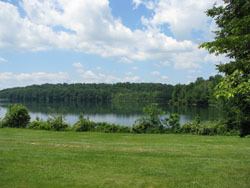
The roughly heart-shaped lake is immediately to the southwest of downtown Carmel. Its 168 acres (68 ha) are surrounded by grassy parkland sloping down to the lake from the roads on the south and east, and woods on the other sides. NY 301 follows the north shore, ascending to its eastern terminus at NY 52 across from the Putnam County courthouse. Route 52 follows the eastern shore for a short distance to the south of this intersection before it, too, ends at US 6, which continues around the southern shore. There is no road along the western side, although a local street, Glenvue Drive, traverses the top of the 545-foot (166 m)-high ridge there.
The lake fills a small depression in the middle of a hilly area. Its bottom continues its rapid drop from the shoreline, reaching a depth of slightly over 100 feet (30 m) in the middle of the lake, equivalent to the surface of a swampy depression to its east. Mean depth is 48 feet (15 m). It typically contains 8.042 acre feet (9,920 m3), or 2.6 billion US gallons (9,800,000 m3) of water.
There are no inlet brooks, as the lake was originally a pond. A small, unnamed outlet brook drains from the northwest, emptying in less than a thousand feet (300 m) to West Branch Reservoir. Water not impounded and delivered to the city from there follows the Croton River to the Hudson.
HistoryEdit
The lake was originally known as Shaw's Pond, after an early landowner. It had been a part of the Carmel landscape since the hamlet's designation as county seat upon Putnam's 1814 creation. It quickly became a popular spot for boating and fishing.
The name started appearing on maps around 1840. Not long after, residents became dissatisfied with the name and proposed grander names for it. In 1852, a committee of local residents finally settled on Lake Gleneida. Eighteen years later, in 1870, New York City bought the lake and dammed it, bringing it to its present size and volume.
RecreationEdit
The New York City Department of Environmental Protection (DEP) owns Lake Gleneida, considered one of three "controlled lakes" in the city's water system. That means it may withdraw water as a right of ownership.
Recreational use of the lake does come under DEP regulations. Fishing, ice fishing and boating are allowed with a valid DEP permit and New York State Department of Environmental Conservation-issued fishing license. Swimming is not permitted.
Boats used in the lake may not be used in any other body of water, to prevent the spread of zebra mussels. This raised some local concern in 2005, since many were left on shore during the offseason and the town found them unsightly as it prepared to spend $2.3 million to spruce up the hamlet. DEP was able to get most of the owners to relocate them to storage areas out of sight of downtown.