
Type Fjord Catchment area 924 sq mi (2,390 km) Surface elevation 335 m Area 134.9 km² | Length 89 km | |
 | ||
Primary inflows Similar Cascade Range, North Cascades National, Echo Valley Ski Area, Lake Chelan State Park, Ruby Theater | ||
The people and places of lake chelan wine country
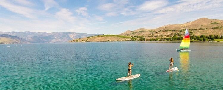
Lake Chelan is a narrow, 50.5 miles (81.3 km) long lake in Chelan County, north-central Washington state, U.S. It is the largest natural lake in the state by any measure. Upon the completion of Lake Chelan Dam in 1927, the elevation of the lake was increased by 21 feet (6.4 m) to its present maximum-capacity elevation of 1,100 feet (340 m). Two communities lie on the southern end of the lake, and a third sits at the far north end, providing a gateway to the North Cascades National Park.
Contents
- The people and places of lake chelan wine country
- Map of Lake Chelan Washington USA
- NameEdit
- HydrologyEdit
- BasinsEdit
- Wapato BasinEdit
- Lucerne BasinEdit
- ClimateEdit
- CitiesEdit
- FishingEdit
- State RecordsEdit
- Protected LandsEdit
- References
Map of Lake Chelan, Washington, USA
NameEdit
The name Chelan is a Salish Indian word, "Tsi - Laan," meaning 'Deep Water'.
HydrologyEdit
On an annual basis, an average of 2,200 cf per second flow into the lake. Approximately seventy-five percent of the water that flows into the lake comes from two tributaries. The Stehekin River alone contributes 65% of all water to Lake Chelan, averaging 1,041 cf per second annually. The other major tributary, Railroad Creek, averages 202 cf per second annually. The remaining water is added via a number of smaller tributaries as well as direct rain and snowfall.
With a maximum depth of 1,486 feet (453 m), Lake Chelan is the third deepest lake in the United States, and the 28th deepest in the world. At its deepest, the lake bottom is 388 feet (118 m) below sea level. The total watershed of the lake is a modest 924 square miles (2,390 km2) More than 90% of the watershed is forested land. The remainder of the basin is composed of the lake itself (5.6%) and agriculture (3.5%).
BasinsEdit
Lake Chelan is composed of two basins. The lower basin, Wapato, is shallower and approximately a fourth the total length of the lake. The upper basin, Lucerne, is much deeper and extends for the remainder of the length of the lake. The two basins are separated by a sill rising to within 122 feet of the surface, at a point known as the narrows, at which the lake is only 0.35 miles (0.56 km) wide. The two basins were created by two independent glaciers that met and then formed the sill when they retreated. First, the Chelan glacier came down from the Stehekin valley and scoured the valley, potentially as far as the Columbia River. Later, the Okanogan lobe came up the Chelan Valley as far as Wapato Point. As the Okanogan lobe retreated, it left huge amounts of debris in the valley originally scoured by the Chelan glacier.
Wapato BasinEdit
The lower basin, Wapato, is the shallower of the two, with a maximum depth of only 400 feet (120 m). About 600 feet (180 m) of glacial sediment and rockslide deposits rest between the lake bottom and bedrock. This section of the lake is 12 miles (19 km) long, and has an average depth of 190 feet (58 m).
Due to the relatively modest size of this basin, water resides in this basin for only 0.8 years, compared to 10 for Lucerne Basin.
Lucerne BasinEdit
Lucerne basin, 38 miles (61 km) long with an average depth of 1,148 feet (350 m), is by far the larger of the two basins. It is in this part of the lake that the maximum depth of 1,486 feet (453 m) is found. Lucerne basin contains 92% of the water in Lake Chelan and 74% of the surface area, leaving Wapato with only 8% of the total volume of water and 26% of the surface area.
The upper basin of Lake Chelan is surrounded by mountainous terrain, resulting in few beaches along the shoreline. Approximately 50 miles (80 km) of the shoreline of this basin are in National Forest lands, and 12 miles (19 km) in National Park lands.
ClimateEdit
The climate of Lake Chelan's watershed is varied. From the southern end of the lake in the rain shadow of the Cascade Range, to the northern tip of the lake located in the eastern Cascades, the climate of Lake Chelan's watershed is as diverse as the lake is long. The south end's weather is notably dry, with Chelan averaging only 11.4 inches (29 cm) of rain per year, along with 21.8 inches (55 cm) of snow. Stehekin receives an average of 35.5 inches (90 cm) of rain per year, and 122.5 inches (311 cm) of snow. Other than precipitation trends, the climates are remarkably similar. Both locations average around 60 °F (16 °C) for a high, and 40 °F (4 °C) for a low throughout the course of the year.
CitiesEdit
Due to the isolated nature of Lake Chelan, especially at its northern reaches, there is not a large population that resides along the shore. Chelan, which had 3,918 residents at the 2010 census, is currently the only incorporated city situated along the lake shore. The city is located at the southern terminus of the lake, adjacent to the Lake Chelan Dam and the Chelan River outflow. The census-designated place of Manson, which had 1,418 residents in 2010, is also located at the southern end of the lake. The unincorporated community of Stehekin, with approximately 75 residents, is located at the northern terminus of the lake, adjacent to the Stehekin River inflow. At the mouth of the Railroad Creek sits Lucerne, a small community of private cabins served by commercial boats. Lucerne is also the primary gateway to the community of Holden Village, a Lutheran retreat center located 11 miles inland from the lake. With approximately 50 long-term residents, Holden includes one of the few remaining public K-12 two-room schools in the contiguous United States.
FishingEdit
Fishing is a favored recreational activity on Lake Chelan. The lake is or was home to a variety of fish species, including Bull Trout, Westslope Cutthroat Trout, Largescale Sucker, Longnose Sucker, Bridgelip Sucker, Northern Pikeminnow, Peamouth, Redside Shiner, Mountain Whitefish, and Pygmy Whitefish.
In addition to these native species, six species have been introduced to the lake, primarily for sport fishing purposes: Yellowstone cutthroat trout, Rainbow trout, Kokanee, Brook trout, Chinook salmon, Lake trout)
State RecordsEdit
There is currently one state record fish that was pulled from Lake Chelan. In 2013, a 35.63 pounds (16.16 kg) Lake Trout was caught, setting the state record.
Protected LandsEdit
At the north end of the lake, surrounding the town of Stehekin, is Lake Chelan National Recreation Area. Surrounding much of the lake on either side is Wenatchee National Forest. Two state parks are located on the southern edge, not far from the city of Chelan. These state parks are Twenty-Five Mile Creek State Park and Lake Chelan State Park.
In addition to the protected land located directly on the shores of Lake Chelan, Stehekin serves not only as a gateway to the Lake Chelan NRA, but also to the rest of the North Cascades National Park Complex, Stephen Mather Wilderness, and adjacent National Forest Wilderness Areas. Approximately 87% of the Lake Chelan watershed is owned by either federal, state, or local entities, with the rest in private ownership.