
Primary outflows Flint River Max. length 20 mi (32 km) Area 34.4 km² Surface elevation 72 m Inflow source Flint River | Primary inflows Max. width 1 mi (1.6 km) Length 32 km Mean depth 3.2 m Outflow location Flint River | |
 | ||
Skeeter zx225 lake blackshear ga run to spring creek 12 31 13
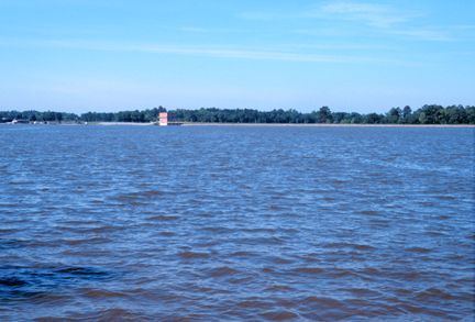
Lake Blackshear is a man-made lake on the Flint River in Georgia created by a dam that was constructed from 1925 to 1930.
Contents
- Skeeter zx225 lake blackshear ga run to spring creek 12 31 13
- Map of Lake Blackshear Georgia USA
- Lake blackshear resort and golf club reviews cordele ga 31015
- References
Map of Lake Blackshear, Georgia, USA
The Crisp County Power Dam, also known as the Warwick Dam, was the first county owned, constructed, and operated power dam in the United States, requiring an amendment to the Georgia State Constitution to make the project legally possible. It came online in August, 1930, under the authority of the Crisp County Power Commission.
The lake is approximately 20 miles (32 km) long and varies in width, but is rarely more than one mile (1.6 km) wide; it covers approximately 8,500 acres (34 km2). It was named for David Blackshear, the founder of Fort Early. When the dam was constructed, little effort was made to cut the trees that would soon be underwater. It was believed that the trees would soon die and decompose once submerged. While this was true for many of the trees, there are still many living Cypress trees in the middle of the lake and there are still many dead trees that have not fallen down.
The Georgia Veterans State Park is located on the east side of the lake. Nestled in the middle of the Park is Lake Blackshear Resort & Golf Club providing visitors with views of Lake.