
Primary inflows Area 28 km² | Primary outflows Mississippi River Surface area 28 km (11 sq mi) Outflow location Mississippi River | |
 | ||
Lake bemidji mn dodge colt recovery 2002
Lake Bemidji is a small glacially-formed lake, approximately 11 mi² (28 km²) in area, in northern Minnesota in the United States. Located less than 50 mi (80 km) downstream from the source of the Mississippi River, it both receives and is drained by the Mississippi.
Contents
- Lake bemidji mn dodge colt recovery 2002
- Map of Lake Bemidji Minnesota 56601 USA
- GeographyEdit
- References
Map of Lake Bemidji, Minnesota 56601, USA
GeographyEdit
The lake is located in southern Beltrami County, near the city of Bemidji, which sits on its southwestern shore. Due to the shape of Lakes Bemidji and Irving, according to folk legends, Lakes Bemidji and Irving were formed in Paul Bunyan's footprint. The Ojibwe described the Lakes Bemidji and Irving collectively as a single lake being a bimijigamaa (lake that traverses another body of water), thus the Ojibwe name the lake as Bemijigamaag-zaaga'igan (Traversing Lake), since the lake is considered to traverse the Mississippi River.
On occasion in Ojibwe, the city of Bemidji is called Wabigamaang (at the lake channel/narrows), since part of the city is situated on the Lakes Bemidji-Irving narrows, located on the south end of Lake Bemidji.
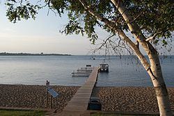
The lake is a popular recreational and resort destination. Lake Bemidji State Park is along its northern shore.