
Max. depth 136 m (446 ft) Area 81 ha | Surface area 0.81 km (0.31 sq mi) Surface elevation 1,956 m Catchment area 24.1 km² | |
 | ||
Water volume 41.1 million cubic metres (33,300 acre·ft) Similar Lai da Nalps, Alps, Lago dei Cavagnöö, Sufnersee, Tomasee | ||
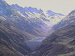
Lai da Curnera is a reservoir on the river Rein da Curnera in the municipality of Tujetsch, in the Grisons, Switzerland. The reservoir is linked to Lai da Sontga Maria and Lai da Nalps in the neighboring valley. The lake's volume is 41.1 million cubic metres (33,300 acre·ft) and its surface area 81 ha (200 acres).
Map of Lai da Curnera, 7189 Tujetsch, Switzerland
All surrounding rivers are diverted into the reservoir, among them the Rein da Tuma, coming from Lai da Tuma (Tomasee), near the Oberalp Pass and known as the source of the river Rhine. The Vorderrhein, or Anterior Rhine as the Rhine is called in this area, passes just about 2 kilometers north to the barrier of the lake. A multiday trekking route is signposted along the young Rhine called Senda Sursilvana, from where the barrier can be spotted easily.